Showing posts with label Sierra del Tigre. Show all posts

Saturday, October 13, 2012

Sierra del Tigre Adventures Part 3: Ex-Hacienda Toluquilla & its 17th Century aqueduct

A rushing stream passes under the 17th Century aqueduct of ex-Hacienda Toluqilla. I found the ruins of this hacienda by accident. Sometimes, when you are in search of one treasure, you stumble across others. In this case I had come into possession of a hand-drawn map showing the location of a large waterfall in the heart of the Sierra del Tigre. This turned out to be Las Cascadas Paraíso (see previous posting). My friend Larry drives a high clearance 4X4, and is always up for an adventure, so I recruited him and three others to see if we could find the as-yet-unnamed waterfall. At that point it was little more than a few squiggles on the map. As we scoured Google Earth to determine the waterfall's precise location, we kept finding mention of an old colonial aqueduct located in the same general area. A bit more internet research revealed that the aqueduct had once provided water to a 17th Century hacienda that had played a role in the founding of the nearby town of Concepción de Buenos Aires. We decided to include a search for ex-Hacienda Toluquilla on our waterfall expedition. However, finding the physical ruins proved easier than finding their history. My information is still a bit sketchy, and if any of my readers can supply more (or corrections), I would appreciate it. For a map to locate Toluquilla, click here.


Ex-Hacienda Toluquilla

The crumbling adobe ruins of the hacienda's Casa Grande stand in the center of the tiny town. Sometime during the Revolution, or not long after, the hacienda's lands were broken up and shared out among the former peones (farm workers) whose families had worked there for centuries as little more than serfs. In many such cases, former peones cannibalized hacienda buildings for materials to improve their own homes. That appears to have happened at Hacienda Toluquilla. Contrary to popular conception, a hacienda was not simply a house where a rich man lived. The word hacienda means "place where something is done or made", and refers to a large economic operation. Haciendas were generally devoted to raising livestock such as cattle and horses, or cash crops such as wheat or sugar cane. The casa grande (great house) of a typical hacienda was both the residence of the hacendado (owner) and the center of an administrative complex called la casca (the helmet).  Generally, Mexican haciendas possessed at least 2000 acres and were relatively self-sufficient. However, some were huge, comprising 65,000 acres or more. Some of these even possessed their own railroad stations. The original size of Hacienda Toluquilla is not clear, but it appears to have occupied a good part of El Llano de San Sebastian, a large rolling plateau in the heart of the Sierra del Tigre, south of Lake Chapala. There was apparently enough land in 1869 for the owners to set aside a substantial portion in order to found the town of Concepción de Buenos Aires.


Next to the ruins of the Casa Grande is the old capilla. Virtually every hacienda possessed its own capilla (chapel). It was usually located very near, or even attached to, the casa grande. From the earliest days of Spanish rule in Latin America, Catholicism provided the ideological justification for the domination by a small wealthy elite over millions of indigenous and mestizo people. The hacendados always kept a watchful eye on the religious messages received by their peones, hence the proximity of the capilla to the casa grande. Under the hacienda system, the meek were unlikely to inherit anything more than their peon father's debts, and the hacendados wanted to keep it that way. Occasionally a hacienda would have its own priest in residence, but in the case of Hacienda Toluquilla, the priest was based far away and faced a long journey to service his flock. In the early 1860s, Padre Ignacio Romo rode a circuit that extended from Hacienda Huejotitánnear Jocotopec on the western tip of Lake Chapala, to Hacienda Toluquilla, deep in the Sierra del Tigre mountains. At the time, primitive roads would have required many days of rugged travel by horse or mule. If he was lucky, the padre may sometimes have had access to a two-wheeled ox cart (unsprung, of course). Not relishing the prospect of continuing this arduous circuit, the padre took the opportunity of a pastoral visit to speak to the owners of Hacienda Toluquilla, the brothers Pablo and Benito Echuari. Padre Ignacio proposed a new town,  to be built on their land, which would have a school, a market and--best of all--a church. To his delight, Don Benito agreed. The town became Concepción de Buenos Aires, and the new church was called Templo de la Inmaculada Concepción. While we found Toluquilla's Casa Grande to be in ruins, the little chapel appeared to be functional. This is not unusual, since the country people remain deeply religious. After the demise of the old haciendas, the capillas began to serve as community churches and social centers for villages like Toluquilla.


The remains of a graceful old arch were among the few clues of former grandeur. When we entered the village, it soon became clear that the old hacienda had been scavenged almost beyond recognition. In such cases, I have found the best thing to do is to approach a local resident, the older the better. We soon encountered a gentleman with a very weatherbeaten face who was dressed in blue jeans and a battered straw hat. He seemed a bit puzzled by our quest, but readily agreed to show us around. As he warmed to our search, he began to point out easily missed details, including the ruins of this old arch, which apparently led into the stable area of the Casa Grande.


Another local resident monitors our progess. This handsome rooster poked its head out of the undergrowth that is slowly overwhelming the Casa Grande's ruins. Village chickens in Mexico are seldom confined, and wander freely in the streets, pecking at whatever they can find. As I outlined in Part 1 of this series, much of the Sierra del Tigre south of Lake Chapala was taken over by Conquistador Alonso de Avalos in the 1540s. He received encomiendas (the right to the forced labor of  indigenous inhabitants) for broad areas including El Llano de San Sebastian. In the early 1600s, these rights passed into the hands of Don Joaquin Fermin Echuari. Encomiendas granted the right to forced labor, but not necessarily ownership of the land. In the 17th Century, the encomienda system was phased out and replaced by Royal land grants through which the great haciendas were created. The land was seized--forcibly if necessary--from the local inhabitants whose forebears had worked it for thousands of years. The former owners of the land became the peones working for the hacendados. The Echuari family kept possession of Hacienda Toluquilla at least until the last part of the 19th Century, and possibly until the final breakup during or after the Revolution.


Maiz now grows inside the adobe walls of one of the casca buildings. Maiz (corn) has been a staple of the rural Mexican diet for thousands of years. Unfortunately, with the passage of the North American Free Trade Agreement (NAFTA) US grain companies have been able to dump huge amounts of surplus corn on the Mexican market. These surpluses, which are subsidized by US government agricultural policies, have depressed maiz prices and undercut small family farms throughout Mexico. This, in turn, has forced the migration of those farmers to work in the fields of US agribusiness north of the border. A large number of those migrant farm workers found it necessary to enter the US illegally in order to feed their families back home. This, of course, makes them easy targets of exploitation by US employers, who profit from low wages and the ability to avoid paying for any benefits such as worker's compensation or unemployment insurance. Just as the old hacienda system turned indigenous farmers into peones, US agribusiness has turned millions of modern Mexican small farmers into "illegals" hunted by US authorities and despised by some (but by no means all) Americans. 


This cut stone provides another hint of the past. We found the stone atop a rough wall surrounding a corral. The walls surrounding Mexican fields are usually built from uncut stones picked up as the fields were cleared. The presence of this carefully cut stone, complete with a rounded edge, indicates that it was originally part of one of the hacienda's casca buildings, possibly the Casa Grande. The lichens growing on the store mean that it was probably cut long ago, perhaps as early as the 1600s. Left undisturbed, lichens can have a lifespan of several centuries.


Mike inspects the Casa Grande. Mike was one of our party of five. He lives in Ajijic full time and owns one of the local real estate agencies. Although we could tell the general orientation of the building, the state of the ruin was such that little else about its interior could be determined with any certainty. By this time, our presence in their pueblo had attracted the attention of a small group of locals. They seemed as curious about us as we were about the hacienda. The kids were the boldest of the lot, as they often are. I had no doubt that our visit would be the talk of their town, since things tend to be a bit slow in this mountain back country. We were happy to provide some free entertainment.


Our local guide pointed out this old stone water trough as one of the original features. What is new is the piped water. In earlier times, water arrived via the stone aqueduct, built in the 17th Century. Today, all homes in Toluquilla are connected to the piped public water supply. According to official government records, the population of the pueblo of Toluquilla is 155 people, with women slightly outnumbering the men. About 40% of the total are children, and 13% are over 60. Of the 37 homes in town, 3 are without floors, and two consist of only one room. While only 29 of the 37 homes have indoor toilets, all have electricity. There are no computers in any of the homes, but 30 have washing machines and 36 have TVs. Although Toluquilla has not quite caught up with the 21st Century, it has at least made it into the 20th.


A sleek horse kicks a hind leg against persistent flies as it munches the thick, juicy grass. This is horse country and kids learn to ride from an early age. We encountered the horse near the gated entrance to the property where the old colonial-era aqueduct is located.


El Acueducto

The aqueduct cannot be seen from the road. It was not until we closely questioned our local guide that we discovered how to find the aqueduct. This gate stands directly across the highway (to the south) from the entrance to Toluquilla. There was no sign indicating an historic site, or forbidding entry, so we parked and walked on through. Not far beyond the gate, you can see a path leading off to the right toward the aqueduct. On the upper left is the creek bed of the stream that used to feed the aqueduct.


Martin and Larry mounted a rough stone path to the top of the aqueduct. By the latter half of the 19th Century, Hacienda Toluquilla was apparently no longer getting its water supply from the aqueduct. I deduced this from information indicating that, in the mid-1860s, the Echuari family donated stone from the structure to help build Templo de la Inmaculada Concepción, the new church in Concepción de Buenos Aires.


This stone trough once carried the water from the rushing stream down the hill to the hacienda. A steady water supply being essential to agriculture as well as to organized community life, aqueducts are some of the oldest civic structures in human history. In the Old World, they date back to at least the Assyrians of the 7th Century BC. The earliest evidence of aqueducts in the New World is in Peru, a development of the Nazca culture around 540 AD. Upon their arrival in 1520 AD at the Mexica (Aztec) capital of Tenochitlán, Hernán Cortéz and his Conquistadors discovered two major aqueducts feeding water to the city. Cortéz conquered Tenochitlán in part by destroying its aqueducts.


After crossing the creek bed, the aqueduct makes a sharp turn up a hill to the right. Notice the heavy growth of moss and liches on the old stones. This structure was built to last, and it certainly has. I have no doubt it would still be providing water if the Echuaris had not found another source, probably a well. If it kept on in the direction you see above, the aqueduct would intersect the creek in another 33 m (100 yds) or so. Out of sight at the upper left is the home of the farmer who owns the land around the aqueduct. 


Mike walks across the aqueduct where it passes over the creek. This has to be one of the most picturesque ruins I have encountered. Before our visit, the hacienda and its aqueduct were virtually unknown within expat community at Lake Chapala. I doubt it is known even by most Mexicans, except those who live in the immediate area. It would be a great place for a picnic, or just to laze away a warm afternoon.


Side view of the aqueduct after it crosses the creek. The arch originally appeared in ancient Mesopotamia in the 2nd millenium BC. The Romans were the first to use it widely as a key feature of their architecture. That was how it made its way to Spain, a Roman province, and from there to New Spain in the 16th Century. The true arch is an architectural form never mastered by the indigenous civilizations of the pre-hispanic Western Hemisphere, although they had developed a precursor called a corbel arch


Another side view of the aqueduct, looking downhill toward the creek crossing. Although I have very little direct information about this aqueduct other than the century in which it was built, it probably functioned in a similar manner to those of other haciendas. One of these was the Espada Aqueduct, built in 1745 in the Texas province of Nueva España. It used a system of floodgates controlled by the mayordomo, or ditch master. He used them to feed water to one field or another, or to provide for bathing, washing, or to power a mill.


Phil peers through one of the arches from across the creek. The great estates of the Echuari family, including this hacienda, extended from the border of Michoacan to the Pacific beachs of Zacoalco, a vast area. Today, the ruins of this old, lichen-covered aqueduct, hidden in the undergrowth near a tiny, backcountry pueblo, provide some of the few clues to the fall in the fortunes of that once powerful family.


Red Bird of Paradise, also known as Pride of Barbados, grew by the road near the aqueduct. One can always depend upon Mexico to provide a burst of color wherever you go. I noticed this plant, formally known as Caesalpinia purcherrima, growing wild beside the road.  I was able to identify it thanks to my flower expert, Ron Parsons.

This completes Part 3 of my Sierra del Tigre series and also the series itself. This area of the Sierra del Tigre is lovely year-round and is relatively untouched by the more negative aspects of tourism which have (in my opinion) somewhat blighted other places in the area like the resort town of Mazamitla. I always appreciate feedback and if you would like to contribute some, please do so in the Comments section below, or email me directly.

If you leave a question in the Comments section, PLEASE leave your email so that I can respond.

Sunday, October 7, 2012

Sierra del Tigre Adventures Part 2: Las Cascadas Paraíso

Water plummets down into a deep canyon near Concepción de Buenos Aires. Las Cascadas Paraíso (Paradise Falls) is also known as Las Cascadas Cruz de Tierra (Cross of Earth Falls). Mexican landmarks often have more than one name, often confusing those trying to find them. I chose to use Las Cascadas Paraíso because that is the name given them by the restaurant at the top of the falls.The waterfall shown above is the last, and biggest, of a series of cascades that move down the canyon like stair steps. The Paradise Falls are located several miles southeast of the town of Concepción de Buenos Aires at the end of a dirt road that is generally passable for street automobiles. For a Google map showing the area, click here.


El Llano de San Sebastian

The countryside leading to Las Cascadas Paraíso consists of a high, rolling plateau. The plateau, called Llano de San Sebastian, has an altitude of 2100m (6890 ft). When we first visited Paradise Falls, wild flowers filled the lush fields we passed along the way. In the distance, we could see large orchards full of ripening peaches. In addition to orchards, we passed broad pastures where cattle and horses grazed. Cutting into the edges of the plateau are numerous deep canyons, including the one that forms Paradise Falls.


Mexican farmers are resourceful about using whatever materials are at hand. In this case, the fence posts are rough tree branches supporting strands of barbed wire. The grass was so deep and thick it almost made me wish I was an herbivore.


And speaking of herbivores... A sleek palomino horse munches contentedly near a field of maiz (corn). Palominos are typically a light gold color with a white mane. They are very popular as parade horses because they stand out. For the same reason, they became popular in movie Westerns and TV shows. Movie star Roy Rogers had a famous palomino named Trigger that Rogers had stuffed and mounted after the animal died. Another palomino named Mr. Ed (who played a talking horse) had his own TV series.


Restaurant Las Cascadas Paraíso

At the end of the dirt road is a rustic, open air restaurant named after the Falls. The owner is a pleasant middle-aged woman who speaks only Spanish. We took note that the local cerveza (beer) is inexpensive, priced at only $15 pesos/bottle. That works out to $1.18 USD, welcome news to thirsty hikers.


The restaurant sits on the crest of a hill overlooking the stream that leads to Las Cascadas. The cloth drapes you see above were pulled down because of the rainy, blustery weather during our visit. The steps leading down in the foreground give access to the stream and the trail to the Falls


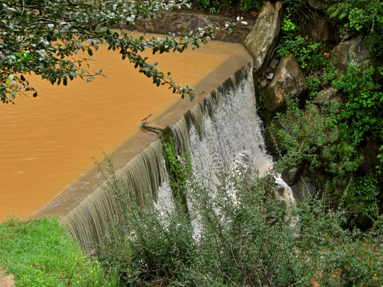
At the base of the steps is a large pond with an overflowing dam. The first of the cascades is actually man-made. The brown color of the water is due to agricultural run-off. We have found the same cafe au lait color in several other creeks running off the Llano de San Sebastian.


The Upper Falls

Below the dam, the first natural cascades begin. In the foreground you can see the path that parallels the stream down to the big falls at the end. The path is an easy walk, although I would strongly recommend good hiking boots or shoes because the way can be wet and slippery. As a matter of fact, I ended up on my butt at one tricky point. My companions enjoyed a good laugh at my expense, after they were assured that the only damage was to my dignity.


A wide variety of vegetation lines the stream banks. Three large maguey plants are grouped together on the far bank. When the water is not foaming white in the increasingly steep stream bed, it returns to its usual cafe au lait color. Maguey has been called "Mexico's Wonder Plant". The ancient indigenous people used it for building their houses, as wells as for twine, clothing, and food. In addition they used maguey to create an alcoholic beverage called pulque, which is still consumed in rural Mexico. After the Spanish arrived, they introduced the distilling process and turned maguey into the drink called mescal. Blue agave, a cousin of mescal, is used to make tequila.


As you move down the canyon, the "stair steps" get steeper. The vertical drop in this waterfall is about 4m (12 ft). Off in the distance, I thought a could hear the roar of a much bigger waterfall.


Wild flowers form a delightful carpet along the banks of the stream. Eryngo (Latin: Eryngium) is a flower found primarily in grasslands. Many of the related species are used for food and sometimes to control inflammations. To those from north of the border, it seems odd at first that Western Mexico wild flowers bloom in Fall rather than in Spring. However, April through June is our hot, dry season. Fall is a cool, moist time of year that these flowers seen to love. My thanks to Ron Parsons, my flower expert, for this identification.


Foaming white water crashes down a another series of steps into a broad pool. There are actually several more cascades in the upper falls area than I show in this posting. I decided to limit my photo display to some of those that seemed more dramatic. Should you decided to visit Las Cascadas Paraíso, you may be surprised at the number of lovely falls you encounter in this section of the stream..


Fruit sprouts from the paddles of nopal cactus. The nopal is another of the wild food plants extensively utilized by ancient indigenous people. In fact, it is still harvested all over Mexico and is even sold at the supermarket where we shop. The green paddles can be prepared in a variety of ways, including sauteed and boiled. Served raw, nopal is crisp, slightly tart, and would nicely complement a salad. The fruits along the edges of the paddles ripen into a deep red color. The tuna, as the fruit is called in Spanish, is about the size of a hen's egg. After carefully peeling off the spiny skin, you will find the pulpy interior to be sweet and tasty.


Near the end of the upper falls, the canyon walls close in and the steps get steeper yet. The constant rising mist encourages the growth of moss and ferns along the water's edge, even as cactus grows a few feet away. At this point, the roar of the lower falls is clear, although they are still invisible.


The Lower Falls

Taking its final drop, the water of the lower falls crashed almost vertically into the canyon bottom. Photographing waterfalls is always tricky, particularly when done from the top. There weren't many vantage points from which I could safely shoot. At the lower right, you can just see the brown pool into which the lower falls flow. Without a point of reference, such as a human figure, it is difficult to appreciate how high the falls really are. At this point the walls of the narrow canyon form nearly vertical cliffs.


A closeup shot of the head of the lower falls. The pent-water blasts out in a curving arc as if from a fire hose. I took this shot with my telephoto zoom. Clambering about these slippery rocks would have been more than a bit risky.


My companions took a break on the viewpoint above the lower falls. From left to right are Phil, a Canadian, Mike, an American, Larry, another Canadian, and Martin, from Great Britain. Like me, Mike and Larry are full-time residents of Mexico. Phil owns a house here, but is a "snow bird" who splits his time between Canada and Mexico. Martin had just recently retired from his job as a homicide detective and was hugely enjoying his several-month Mexican adventure.


From the viewpoint, we could see a beautiful valley, lush and green, spreading out below. Although it is fairly wide, the low mountains ringing the valley give it a secluded feeling. This valley is typical of the many found nestling between the ridges of the Sierra del Tigre.


Directly below the viewpoint, the stream begins its flow down the narrow lower canyon. Once again, my telephoto lens makes the bottom seem closer than it really is. Our stroll down the path to the lower falls viewpoint was not tiring, and the lower canyon looked intriguing. There was no apparent route down from the head of the falls, so we decided to look for the canyon mouth and approach the falls from below.


The Canyon Bottom

Martin forces his way through the thick brush of the canyon bottom. After driving around hairpin turns down into the valley, we set off on foot in search of a trail that might take us to the base of the lower falls. This involved a good deal of what my fellow hikers euphemistically call "bush whacking." The process involves physically forcing your way through the brush, sometimes whacking at it with your hiking stick. I have broken several very good sticks this way. The brush often fights back with stickers and brambles that can leave bloody scratches on unprotected arms and legs. In this case, the brush was not only thick, but very wet.


We followed the stream, the only clear part of the jungly canyon bottom. The water still retained its cafe au lait color, even after tumbling over multiple cascades on its way down the canyon. The light brown color contrasted nicely with the deep green of the forest vegetation.


Phil emerges from thick brush onto a narrow trail. He has just landed from a jump over a deep ditch and is balancing on his hiking poles. Like many hikers,  he carries two poles, which look like ski poles without the little basket at the tip. They are adjustable to height and have grips that are molded to the hand. However, such poles can be expensive and I prefer an old handle from a mop or broom with rubber tips at each end. If I break one or lose it, the cost to replace it is negligible.


A large bromeliad grows out of the crotch of a tree. Bromeliads like this are distantly related to pineapplesAfter a few hundred yards, we became so soaked from brushing against the wet vegetation that we gave up the effort to find the bottom of the falls. On a second attempt several months later, we failed again. That time we ran into a large swarm of angry, Africanized bees. Stumbling, flailing and tripping, we were pursued almost all the way back to our car. I didn't even realize that I had lost my hat and eyeglasses until I got back to the road. To the best of my knowledge, the lower canyon has yet to be explored by expat hikers.

This completes Part 2 of my Sierra del Tigre series. I always appreciate feedback, and if you would like to comment please do so in the Comments section below or email me directly.

If you leave a question in the Comments section, PLEASE leave your email address so that I can respond.

Hasta luego, Jim


Sunday, September 30, 2012

Sierra del Tigre Adventures Part 1: A visit to the mountain town of Concepción de Buenas Aires

A quiet winter day at the Plaza. The plaza of Concepción de Buenas Aires and the streets around it are rustic, but immaculate. Over several years, I have on numerous occasions passed through this small town, usually while on the way to somewhere else. On a couple of occasions, however, I took some time and looked around. The little mountain community turned out to be yet another of Mexico's seemingly endless supply of hidden jewels. Concepción de Buenas Aires is located in the Sierra del Tigre, a range of rugged mountains to the south of Lake Chapala, about 90 minutes by car from our home in Ajijic on Lake Chapala's North Shore.  The town can be reached by turning southwest off the highway connecting the South Shore town of Tuxcueca with Mazamitla, a popular mountain resort. The turnoff is about half way to Mazamitla, shortly before reaching Manzanilla de la Paz. The two-lane blacktop road passes small ranches and farms set in the lush green fields of a high-country plateau called El Llano de San Sebastian. Fat cattle graze while the occasional Mexican cowboy trots past with a string of beautiful horses. I recently decided to create a three-part series about the town and the area around it, including Las Cascadas Paraíso (Paradise Waterfalls) and the ruins of Hacienda Toluqulla. This first part will focus on the town itself. To locate Concepción de Buenas Aires on a Google map, click here.


El Templo de la Inmaculada Concepción

The banner-bedecked steeple of the Templo shows evidence of a recent fiesta. Construction began in 1864, so the Templo is relatively new, like the town itself. The steeple was built in the Neo-Classical style popular in the 19th Century. The dark, cloudy weather in this shot indicates that it was taken in a different season than the bright and brilliant winter scene of my plaza photo. You may notice these seasonal disparities throughout this series since the photos were taken during several different visits.


The main nave of the Templo is beautifully hung with blue and white draperies. The windows near the ceiling on either side give this room an unusually light and airy feeling. During my research for this posting, I discovered that on June 7, 2012, TV Azteca News reported the discovery by  parishioners of an image of La Virgen de la Concepción Inmaculada which had suddenly appeared on the wall behind the altar (center of the photo). The Virgin is the patron saint of both the Templo and the town itself. Since the image was apparently not visible at the time I visited, I unfortunately did not get an opportunity to see if I could photograph it. Jalisco is one of the most traditional of all Mexican states. The Catholic faith is particularly intense in backcountry towns like Concepción de Buenas Aires.


My photographer's eye was attracted by this exuberant scene. An absolute bee-swarm of cherubs framed this statue of the Virgin. Cherubs were popular decorative elements in 19th Century art and architecture.


San Isidro Labrador seemed especially appropriate for this working-class town. San Isidro the Laborer (or the Farmer) is the patron saint of farm workers. He is particularly revered for his goodness toward the poor and animals. Isidro, born 1070 AD, was a laborer on the estate of wealthy Spanish landowner Juan de Vargas. His fellow workers claimed that he was absent a lot and not doing his share. When the landowner investigated, he found Isidro at prayer while an angel took care of his plowing. On another occasion, Isidro brought Juan de Vargas' dead daughter back to life. All this seems to have gotten the wealthy man's attention, because he ultimately made Isidro the manager of his properties. Oddly, the farmer-saint married a woman, Maria Torribia, who also became a saint and is known as Santa Maria de la Cabeza. After a miracle saved their child, the couple decided on chastity and from then on lived in separate houses. Isidro died in 1130 AD. Four hundred years later, Spanish King Phillip II (the one who launched the Armada against England) was cured of a deadly disease when he touched some relics of the deceased saint.


La Plaza

A small but lovely kiosco fills the center of the Plaza. Several walkways radiate from the kiosco, passing through lush gardens. Concepción de Buenas Aires is also known as Pueblo Nuevo (New Town) because it was not built until the mid-19th Century. The area on which it was constructed, called El Llano de los Conejos (The Plain of Rabbits), consisted of rolling farmland and woods until the 1860s. The area was originally part of the vast lands awarded in the 1540s to Captain Alonso de Avalos, one of the Hernán Cortéz' conquistador officers. He was also awarded the lands along the South Shore of Lake Chapala about which I have already written in my posting on Hacienda San Francisco de Assisi. In the early 1600s the land passed into the hands of a Spaniard known as Don Joaquin Fermin Echuari, and remained in his family for the next 200 years.


Rafael Urzúa Arias is memorialized by this statue in the Plaza. Urzúa, born in 1905 in Concepción de Buenas Aires, was a famous Mexican architect whose life spanned the 20th Century. His work is noted for its freshness, naturalness, and playfulness, and he is ranked with Luis Barrigan as one of Mexico's great 20th Century architects. The statue was erected in 1988, three years before Urzúa's death in 1991. 

Back in the early 1860s, Benito Echuari, a descendant of Don Joaquin Fermin Echuari, was approached by Father Ignacio Romo, a parish priest based in the town of Teocuitatlán. In those days, parish priests had to cover far-flung areas, requiring them to travel for many days over primitive roads. Father Ignacio's parish extended from the Hacienda Huejotitán, near Jocotopec on the west end of Lake Chapala, to the Hacienda Toluquilla in the Llano de San Sebastian. The priest proposed to Benito Echuari, who owned Hacienda Toluquilla, that he should set aside some of his land for a town which would have its own church, as well as a market and school. So, Concepción de Buenas Aires came about--at least in part--because of a priest's saddle-sores!


Independence War leader Father Miguel Hidalgo y Costilla has his own statue. While Hidalgo is revered as the first great leader of the War of Independence from Spain, and as emancipator of the slaves and indigenous people, his actual role lasted only about a year until he was defeated, captured, and executed by the Spanish who displayed his head as a trophy in Guanajuato. Father Hidalgo is an excellent example of the old saying that you can kill the man, but not the idea.

One hundred fifty years later, Benito Echuari and his son Pablo thought Father Ignacio had an excellent idea. I suspect that their enthusiasm had less to do with saving souls than with the prospect of a great increase in economic activity which would benefit Hacienda Toluquilla. They set aside El Llano de los Conejos, along with an area called Lomas de San Sebastian (Hills of San Sebastian), and recruited about two dozen settlers of Spanish descent called criollos. They even allowed the use of stone from their hacienda's aqueduct to be used in the construction of the new church. With the blessing of Guadalajara's Bishop Pedro Loza y Pardavé, the town was formally founded in 1869. The community grew quickly and only 19 years later, in 1888, it became the chief town of the new municipalidad (equivalent to a US county) called Concepción de Buenas Aires.


The portales along one side of the plaza stand empty on a winter morning. Mexican businesses in small towns don't generally get going until mid-morning, but often stay open until late in the evening. We arrived on this visit about 9 AM and the Plaza and streets around it were eerily empty, almost like a movie set. Although Concepción de Buenas Aires is not old by Mexican standards, it feels old, kind of like a 19th Century town frozen in amber.


Farmacia Maria Isabel is one of numerous small businesses facing the Plaza. The shop sign just beyond, with the head of a cow, announces a carneceria, or butcher shop. This shot was taken in mid-afternoon when activity had picked up some. Even so, things are slow and fairly quiet most days in this off-the-beaten-track mountain town. There always seems to be time for locals to chat on a bench or lounge against one of the columns supporting the portales.


Just beyond the carneceria is the Restaurant Las Espuelas. The name means "The Spurs". This is definitely a cowboy joint with old photos of Pancho Villa covering the walls. Many small town plazas lack any kind of sit-down restaurant, perhaps because there is often little extra money for dining out and local people tend to eat at home. However, Las Espuelas was a genuine, full-service restaurant and the traditional Mexican fare was tasty and inexpensive.


Two of our party found dessert down the block from Las Espuelas. While many Mexican plazas may lack a restaurant, there will nearly always be an ice cream parlor. Above, Phil (a Canadian) and Mike (an American) salute me with their newly-aquired ice cream cones. They were part of a hiking expedition to explore a nearby canyon reported to possess a large waterfall. The local folks observed us with friendly curiosity.


Street scenes

Big cowboy, small horse. Judging from the type of shovel he has strapped under his leg, this fellow has just returned from digging some fence post holes. I have become used to scenes like this, even in the more urbanized areas near where I live. When I emerged from my house in Ajijic this morning, there were three loose horses grazing along the sidewalk across the street. Even as I sit writing this, I can hear cattle lowing in the distance. It is one of the many charms of life in Mexico.


The new and the old. As we strolled the streets of Concepción de Buenas Aires, we came upon this scene. I thought the burro tethered next to modern farm machinery was a good metaphor for Mexico today: the old ways existing side-by-side with the new. Mexico has 3 million burros, one of the largest populations in the world. They arrived in the Americas on Columbus' second voyage in 1495, and in Mexico in 1528. However, they have been used in Europe and the Middle East since biblical times.


Tianguis Day falls on Tuesdays. On one visit, we encountered a crowded local tianguis, or street market, near the Plaza. Tianguis is a Nahuatl word, from the language of the Aztecs. In his book "The Discovery and Conquest of Mexico", Conquistador Bernal Diaz del Castillo described the great tianguis of Tenochtitlán, the Aztec capital (now Mexico City). Except for details like clothing, and some of the goods on sale, the scene wouldn't have been much different from this.


Weighing it the old fashioned way. A scale like this would have been completely familiar to anyone attending a similar tianguis in the newly founded Concepción de Buenas Aires of 1869. Even though digital scales can often be found in Mexican stores, many people see no reason to change from the old ways. If a scale like this still works, why spend money on a fancy new one?


Speaking of ancient technology. Mike and Anna, a young Dutch hiker, examine a classic specimen of automobilius wrectus, possibly with an eye toward a purchase...or not. This car was so battered and disreputable, it was almost a cliche. When I first moved down to Mexico, I expected the roads to be filled with this kind of clunker. I was surprised to find many shiny, up-to-date models, even in small towns. It was not clear what the asking price for this one might be. Any takers?


A friendly townsman invited us to tour his house. We were preparing to get in our car when Mike, a friendly sort of guy, began to joke with a young boy standing in a nearby doorway. A moment later, the boy's father strolled up the street, introduced himself, and invited us in to see his place. Since the vast forests of the Sierra del Tigre are very near by, wood is heavily used in construction of homes and other buildings. This gentleman beautifully decorated the interior of his home with pine panels and wood furniture, some of which you can see here.


A private collection of ancient artifacts. The homeowner constructed a coffee table out of a huge gnarly stump, and used it to display a variety of small objects he had collected in the area over the years. It is not at all an unusual experience to be invited into the homes of Mexicans we meet, even when we are complete strangers to them.


Concepcion de Buenas Aires made it to the Oscars! As we strolled about the streets, we passed the "Bar Melis", a small, rustic cantina. It was closed, but I noticed this plaque next to the door. The sign says "In this place was filmed part of the movie 'De Tripas Corazon', nominated for an Oscar in '97, by director and writer Antonio Urutia". I later Googled this information and, sure enough, Urutia's short film got a nomination that year, but alas did not win the famed gold statue. Concepción de Buenas Aires is certainly a scenic and evocative town and I could well understand its choice as a film set.

I hope you have enjoyed Part 1 of my Sierra del Tigre series. Next week, in Part 2, we will visit Las Cascadas Paraíso, a huge waterfall pouring down into a deep canyon. I always appreciate and encourage feedback. If you would like to leave a comment, please do so either in the Comments section below, or by emailing me directly.

If you leave a question in the Comments section, PLEASE leave your email address so I can respond.

Hasta luego, Jim