Showing posts with label Beaches. Show all posts

Friday, July 30, 2021

Beach towns of the Central Pacific Coast: Chacala

Most of Chacala's short crescent beach has gently sloping sand. Only on the south end does it become more rocky. We have visited Chacala a number of times over the years and its serenity and rustic charm has made it one of our favorites. The little beach town is a bit like Sayulita, before that place got "loved to death" by the folks with money and became overrun with expensive beach homes, condos, and boutique shops. 

Chacala may have (so far) avoided this fate because it is relatively remote from Puerto Vallarta. Thus, it has largely escaped the notice of those who jet in from afar, seeking resort destinations that have all the comforts and conveniences of home. Perhaps Chacala will undergo changes similar to Sayulita in the future. For now, it retains the slightly down-at-the-heels quality and off-the-beaten-track charm that Carole and I like.  


Chacala's nearest neighbor of any size is the town of Las Varas. The coast road between Rincon de Guayabitos and Chacala stretches 29.8km (18.5mi), about a 40 minute drive. Just before reaching Las Varas, look for a sign that says "Playa Chacala" and then turn left at the Oxxo convenience store. A well-paved two-lane road winds through 11.8km (7.3mi) of coastal jungle and enters Chacala from the south.

The town's two main streets parallel the shore and are bisected by several short streets. Walking at a brisk pace, you could probably cover the whole "downtown" in 15 minutes or so. There are a number places selling nicknacks and other shops that sell or rent gear for swimmers, snorkelers, divers, and those favoring boogie or surfboards. 


The southern portion of the beach is scattered with large rocks. However, near the waterline, the sand is smooth and walking is easy. Only a couple of people strolled the beach during the late morning when I took this shot. You'll likely encounter more folks than this at the northern part of the crescent, but it would still be a stretch call that area crowded. 

Where the southern end of the shore turns out toward the point, the beach mostly disappears and the steep jungled slope comes right down to the water. In the upper left quadrant of the photo you can see a light colored structure built into the cliff (just above and slightly to the left of the figure on beach). That is the subject of my next photo.


One of the more unusual homes you will find in Chacala. The builder constructed the house as a series of steps from the rocky shore up the mountainside. Whoever lives there had better have good knees! Also, since the Pacific Coast of Mexico is subject to the occasional tsunami, the occupant had better hope s/he is in one of the upper levels when the wave arrives.


Most of the hotels and rental bungalows are located in the town. Few if any structures here have more than four stories. This provides a welcome relief from the glass and steel towers that dominate Puerto Vallarta. The structures along the beach are called palapas. Roofed with palm-fronds, their floors are beach sand. One of the main reasons we find Chacala so attractive is its human scale.


An RV park nestles in a palm grove just south of town. I'm not sure what hook-ups or other services are available here. Since I don't own an RV, I didn't think to inquire. However, this being Mexico, I'm pretty sure the charges are modest and whatever is not available here can be obtained a short walk down the beach. The folks who own the vehicle above seem to have settled in nicely.


Another alternative: sleep on your sailboat. We saw several sailboats in the small bay. This one was anchored next to the line of boulders that marks the shoreline along the northern point of the crescent. There is no beach along here, since the steep hill comes right down to the water. Some people have built houses along the top of the point, but they are relatively secluded in the vegetation.

 
What to do in Chacala?


Boogie boarders frolic in the surf. Chacala has gentle surf and the water is usually calm. Big-wave surfers should probably look elsewhere. However these conditions are great for boogie boarders, swimmers, snorkelers, and those who just want to get wet to cool off. 


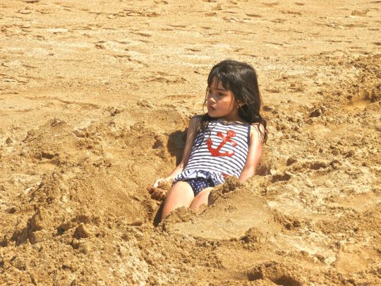
Playing in the sand can also be entertaining. Beach sand seems to have a special attraction for small children and dogs. This little girl has nestled herself into some cool moist sand as she considers her next move. 

Running, jumping, and digging in loose sand are among the favorite activities of canines, as well as kids. I have seen dogs vigorously digging on the beach just for the sheer joy of making the sand fly.


Rocks along the shore inspire those with artistic inclinations. Got time on your hands on a slow day? Here's an entertaining possibility that only requires a bit of patience and imagination and no cost at all. You may even find your masterpiece enshrined in a blog like mine.


There's always seating available under these open-air palapas. While there are restaurants on some of the streets in town, the best dining experience--in my opinion--will be found in the large palapas that line the northern section of the beach. With the surf gently rolling in a few yards away, you can eat fresh seafood and sip on a cold margarita.


And, speaking of margaritas... It's hard to beat the cool shade of a beach palapa on a hot afternoon. As you gaze out over the blue Pacific toward the far horizon, you may find yourself "Wastin' away in Margaritaville". Jimmy Buffet would feel right at home here. My guess is, you would too.

This completes my posting on Chacala and my series on Mexico's Central Pacific Coast beaches. I hope you have enjoyed it. If so, please leave any thoughts or questions in the Comments section below or email me directly. If you leave a question, please include your email address so that I can respond.

Hasta luego, Jim


Friday, July 23, 2021

Central Pacific Coast beach towns: La Peñita de Jaltemba & Punta Mita


The malecon of La Peñita de Jaltemba was serenely quiet. A malecon is a paved walkway along a seashore or lake. Even though it is mid-day, we could see only one person on either the malecon or the beach. Unlike Rincon de Guayabitos, just to the south, La Peñita's waterfront wasn't thronged with tourists, at least not when we were there. Although we enjoyed Guayabitos, it was a bit of a relief to get a break from its hustle and bustle.

This is the second of a three-part series on beach towns along Mexico's Central Pacific Coast. This time, we'll visit La Peñita and Punta Mita, two relatively quiet resort towns. Like Guayabitos, La Peñita attracts middle and working class Mexican families. Punta Mita, in contrast, is more up-scale (and more expensive). This is probably due to its proximity to nearby Puerta Vallarta.


Map showing La Peñita, just north of Guayabitos. The two towns are separated by Arroyo Guinea, a river that extends from just east of Highway 200 to the shore. Stone breakwaters extend out into the bay on either side of the mouth of the arroyo. Home to a bit more than 9,000 residents, La Peñita is the largest of the three towns along the shore of Bahia Jaltemba

This area of Mexico's coast gets 320 days of sunshine a year. The best time to visit is between November and May, when the temperature ranges from 25C-29C (78F-85F). Between June and October, the temperature can skyrocket with sweltering humidity.


Looking south from the malecon. Again, the beach is empty and serene. In the distance you can see one of the stone breakwaters at the mouth of Arroyo Guinea. The beach directly in front of town is 1.5km (1 mi) long, with calm water and light surf. At the northern end is a rocky point, but beyond that El Playón Beach stretches out for five beautiful miles with little development.

According to local legend, the town was founded by Mexicas  (Aztecs)They paused here for a bit during their 13th century AD migration from their ancestral home of Mexcaltitán, on their way to Lago de Texcoco in the Valley of Mexico. 


Beach combing produces another stranded fish. We came across this large, silvery fish with a forked tail. A friend who is an avid fisherman suggested that it is part of the tuna family, possibly a Black Tuna. If there are any ichthyologists out there who can shed any light on this, I'd be glad to hear from you.  The tracks around the carcass indicate that one of the local dogs has also been investigating.


A statue of a dolphin and her calf adorns the town's small plaza. In the background, the kiosco (bandstand) has an unusual white dome, topped with a more traditional tile roof.  While the malecon and beach were virtually empty, there was considerably more activity along Avenida Emiliano Zapata, La Penita's main street. It runs perpendicular to the shore, from Highway 200 all the way to the malecon. Along it, one can find many shops, and restaurants.

Punta Mita

A paddle boarder rides the surf. I got a number of shots of this fellow, but the one with the swooping pelican was the most dramatic. Paddle boarding is only one of the many water-related activities available at Punta Mita. Swimming, snorkeling, scuba diving, boogie boarding, surfing, fishing, sailboating, and yacht-cruising were among the many others. Our choice was a leisurely stroll along the beach.


Punta Mita is a point of land that looks like the head of a vulture. The largely private 1,500 acre point is located 16km (10mi) north of Puerto Vallarta and is 47km (29mi) south of GuayabitosThe access road to Punta Mita is located where Highway 200 takes a sharp right-hand turn toward the northeast.

There are a number of wealthy developments on the point and many coves with small beaches. We visited one of these at the small town of Corral del Risco (Cliff Corral) located on the southern shore of the point. To zoom in with a Google map, click here.


About half of the cove is covered with small rocks. The southern end has more sand, as does the beach just to the north. There are a number of establishments covered with palapa (palm frond) roofs lining the shore. These offer meals and other amenities. At the time we visited, the beach was nearly as empty of visitors as the one at La Peñita.


This palapa restaurant was part of the hotel next door. Another popular activity is to hang out under the shade of a beach umbrella while drinking large goblets of Margaritas. A tough job, but somebody has to do it. 


Boogie and surf boards are available to rent at this place. I didn't check, but I assume other water gear like flippers, masks, and snorkels can also be rented inside. If not here, it wouldn't be hard to find them someplace nearby.


A small launch and a large yacht each ride at anchor off shore. They reminded me of the "Mutt and Jeff" characters in an old comic strip. The launch would be more in line with my bank account. Notice the Brown Pelican perching on the outboard motor of the launch. These birds immediately assume ownership when people are not around.

This completes my posting on La Peñita de Jaltemba and Punta Mita. I hope you have enjoyed it. Next time, we'll head north from Guayabitos to Chacala, another beautiful and relatively uncrowded spot. If you would like to leave any thoughts or questions, please do so in the Comments section below or email me directly.

Hasta luego, Jim


Thursday, July 15, 2021

Beach towns of the Central Pacific Coast: Rincon de Guayabitos

Golden afternoon sun bathes the palm-fringed shoreline. This is the northern end of Rincon de Guayabitos. Behind the palms are small hotels and homes. All along the shore of the Central Pacific Coast of Mexico, there are a number of beach towns located in the bays and coves. In past years, I have posted stories about some of the better-known towns including Manzanillo, Barra de Navidad and Melaque, Puerto Vallarta, San Blas, and Mazatlan. 

In this series, we'll visit some of the smaller places that lie between Puerto Vallarta in the south and San Blas in the north. This first post will focus on Rincon de Guayabitos, (or simply Guayabitos, as it is often called). Future parts of this series will take a look at the other beach towns of Punta Mita, La Peñita de Jaltemba, and Chacala. All of these beach towns are smaller, quieter, and less overrun by foreign tourists than their better-known counterparts. Each of them is worth a visit.


Overview

Map of the coast from Puerto Vallarta to Chacala. For some unknown reason, this Google map shows Rincon de Guayabitos as Rincon de Nayarit. However, when you zoom in on Google, the correct name appears. Punta Mita is at the tip of the point extending out just north of Puerto Vallarta, near the town of Corral de Risco. The distance from Guayabitos to Punta Mita is 47km (29mi) 

La Peñita de Jaltemba is not shown on the map above unless you zoom with Google. It adjoins Guayabitos just to the north. Chacala is located in a small bay at the top of the map, about 30km (18mi) north of Guayabitos. Highway #200 is the coast road that connects all these beach towns. Although the distances may appear fairly short, the highway is two-lane and winding, so traffic can be slow. However, you are on vacation so enjoy the scenery.


Rugged, heavily forested mountains stand just back of the coastal plain. In some areas, the mountain slopes extend right down to the sea. These formations are part of the Sierra Madre Occidental, one of Mexico's two great north-to-south ranges. 

The mountains crowd the shore closely, leaving the Central Pacific Coast with few really long beaches. Instead, the coast is a series of bays and coves of various sizes, separated by steep points of land that extend out into the ocean. This separates and isolates the beach towns, providing each place with a sense of uniqueness. 


Fishing boats rock gently in the southern end of the bay. Local fishermen sell their catch to Guayabitos' many restaurants. This means that fresh fish is on the menu almost everywhere. I took this photo at the rincón ("corner") where the shore turns sharply to the west, ending in the point of land that defines the southern boundary of the bay. 

Rincon de Guayabitos is Spanish for "Corner of the Small Guava Trees". Most of the developed part of the town extends inland for several blocks from the shore. The southern end begins at the rincón, and runs north along the coast for a couple of kilometers to the point of land that separates Guayabitos from its close neighbor, La Peñita de Jaltemba

A stroll along the beach

A Mexican family lounges under beach umbrellas.  In the background stands Hotel Torre Blanca, one of the town's more upscale hotels. However, there is a wide variety of accommodations in Guayabitos, suitable for almost any budget. 

Carole and I stayed at the mid-range Hotel Costa Alegre, a very comfortable "all-inclusive" place, popular with Mexican families. Like the Torre Blanca, our hotel overlooked the beach and we had a third floor room in the center with an expansive view of the bay.


Beach vendors are popular with both people and pelicans. Brown pelicans have learned that they can often grab a quick snack without the trouble of diving for fish. They seem quite unconcerned with their close proximity to the human customers. 

Although I have occasionally seen a pelican try to steal a bit of food from an unwary vendor, usually the big birds wait politely for their handouts. They will, however, freely squabble among themselves. Brown pelicans are among the more entertaining creatures you will encounter along the coast.


Isla del Coral is an island about one mile off shore. The limestone dome is surrounded by a coral reef that teems with fish and birdlife. The island is only about a ten minute trip by launch and has become very popular with the snorkel and scuba set. You can rent snorkel equipment and there are diving instructors on the island for those who want to visit the underwater world. We didn't have time to visit Isla del Coral, but it's on my list for a future trip.


A fisherman wades ashore with his catch of the day. He anchored his boat in waste-deep water a few yards offshore. His single fish is likely destined for his family table, rather than a restaurant kitchen. Mexican fishermen are a friendly and hospitable lot. I have never been refused a photo of them displaying their catch of the  day. 


A Row of flags stands in front of some palapa restaurants. I was amused by the selection of banners. From the left: the Canadian national flag, the Alaskan State flag, a Harley Davidson banner, a flag for Pilsner Beer, and the Mexican national flag. Why that particular collection, in that order, is still a mystery to me.


Cotton candy vendor displaying his wares. Mexican beach towns attract lots of wandering vendors. Some visitors consider this a problem and would like them controlled or even banned. However, I am usually sympathetic to their efforts. Everyone has to make a living and one of the harder ways is to haul your goods up and down the beach all day under a hot sun. If I am not interested in their wares, all it usually takes is a polite "no, gracias" and they move on.


A Porcupinefish bristles with the spikes that give it the name. We encountered it as we were strolling along the tide line. This species of Porcupinefish (Diodon hystrix) is one of seven species of Diodon, four of which can be found in Mexican waters. 

When threatened by a predator, it inflates its body which causes the sharp spines to point out in all directions. These are defensive mechanisms to ward off dorados, sharks, wahoos and other predators. In addition to being sharp, the spines can contain a potent neurotoxin called tetrodotoxin. We kept a respectful distance.


Watching the shore Birds watch us

A Brown Pelican looks me over with a rather disapproving eye. They are graceful while soaring through the air or paddling over the water's surface. On land these pelicans are comical, often reminding me of Charlie Chaplin as they waddle about. They will often flap their wings, squawk. and push aside other pelicans to get at a tidbit of food. 

Pelecanus occidentalis can be found on Mexico's Pacific, Atlantic, and Gulf Coasts. The one above appears to be a juvenile because it lacks the white or yellowish head that adults have. Brown Pelicans are resident (nonmigratory) birds who are very gregarious and like living in flocks. When feeding, they glide along in the air just above the water. Upon spotting a fish, they will go through a complicated set of aerial maneuvers to gain altitude and then dive straight down into the water.


A Snowy Egret stands in the shallows with a small fish in its beak. I have often seen these birds (Egretta thula) fishing in the shallows of Lake Chapala, near where I live. However, they can most often be found along the seashore. While hunting for prey, the Snowy Egret will wade slowly and cautiously in a few inches of water. Suddenly, the bird's neck will stretch out and its sharp bill will dart into the water. Quite often they are successful, like this one. 

The Egret will maneuver the fish in its beak into position, then throw back its head and swallow. I once saw an Egret try to do this with a small snake. While attempting the usual maneuver, the Egret was surprised to find that the snake had wrapped its body tightly around the bird's bill. The snake couldn't get away, but the Egret couldn't swallow it, creating a classic Mexican Standoff! I had to move along, so I never found out who won.


A Willet hunts for lunch while standing on one leg. At first, I thought the Willet (Catoptrophorus inornata) had become disabled or had lost its other leg to a predator. However, while researching shorebirds, I found a photo of a whole flock, each standing on one leg. Apparently the other leg is drawn up under the belly feathers in order to conserve body heat. This process is called "rete mirabile"

The Willet is one of many species of Sandpipers. These birds are found along the shore, just inland from the waves. They poke their beaks into the wet sand or mud, looking for small mollusks and other invertebrates. The Willet is migratory, breeding in the prairie provinces of Canada and the Northern US and wintering along the Pacific shore as far south as South America.


A Frigatebird glides along the beach. Also called the Man o' War, Fregata magnificens is found in tropical and subtropical waters off the Americas from northern Mexico to Peru. This one is a female, because the males have a red sac under their throats that they inflate as a display during mating season. 

Frigatebirds catch prey like flying fish on the surface of the sea. At times, they may engage in the nefarious practice of kleptoparasitism--harassing other birds in order to force them to regurgitate their food. Christopher Columbus noted this practice in his journal when he visited the Cape Verde islands on his 1492 Voyage of Discovery.


Things to do

The Barco Fiesta Guayobitos tour boat is anchored offshore. The small launch behind it ferries tourists to and from the bigger boat. Be advised that Barco Fiesta Guayobitos is a "party boat". It attracts large numbers of young people who enjoy loud music, dancing, and drinking. However, it also offers excursions to observe migrating whales during that season.


Ride on a "banana boat" while being pulled by a powerful jet boat. Passengers sit one behind the other on the inflated sausage and hold on to the handles. Part of the fun is being launched into the water at full speed when you hit a wave. This is not for the faint of heart or those afraid of getting wet.


Go fly a kite. These can be purchased at various stores in town. Since there is usually a breeze along the beach, getting one of these launched shouldn't be too difficult. Getting it down from on top of a tall palm tree might be more problematic.


Say "¡hola!"to the locals while you stroll along the beach. Although there are rocky spots like the one above, most of the beach is smooth sand. However, be careful during the middle of a sunny day. The sand can scorch your soles if you are unwary, long before you can get to the water's edge.


Stop for a cold one at a bar called "La Ultima Parada". Located right at the rincon, "The Last Stop" bar is, indeed, the last place advertising a drink on the way out to the point. Actually, the place looked a bit deserted and forlorn when we came by, and I'm not certain it was still open for business. Still, I liked the name.


Just lie back on the sand and let the water lap over you. This is the beach version of being a couch potato. A father and his young daughter were enjoying themselves in this fashion as we  passed by. It's certainly a good a way to deal with the mid-day heat.


Hang out with goblets of margaritas while watching the sunset. These can be spectacular at times (both the margaritas and the sunsets). Above, the sun is just about to drop behind the point of land at the southern end of the bay.

This completes the first part of my Central Coast beach series. Next time, we'll visit La Peñita de Jaltemba, just north of Guayabitos. I hope you enjoyed this posting. If so, please leave any thoughts or questions in the Comments section below, or email me directly. If you leave a question in the Comments section, please include your email address so that I can respond.

Hasta luego, Jim


Tuesday, August 27, 2019

Exploring Campeche

Campeche's Cathedral, viewed from under the arches of the Regional Museum. The Cathedral and the Palace containing the Museum form two sides of the Campeche's main plaza, called Plaza PrincipalOur first visit to Campeche was with Caravan Tours back in the winter of 2010. Our brief 48 hour stop provided very little time to explore the city and no time at all to investigate the Maya ruins in the countryside. However, my interest was aroused. I was determined to return to see what treasures this small Mexican state might hold. This posting is the first of a series about our adventures in Campeche in December of 2018. Hopefully it will encourage you to check it out yourself.


Overview

Map of central and northern Campeche. Located on the Gulf Coast, the city of Campeche is the capital of a state with the same name. In colonial times, it was a major port and entry point to this part of the Yucatan Peninsula. On the map are pyramid symbols of various sizes. These show the locations of ancient Maya cities. Of the nine shown, we visited five , including Edzna, Hochob, Tahcok, Xtampac, and Xcalmukín.

We also toured the spectacular ruin of Kabah, just across the state line in Yucatan. Two other sites we visited that are not shown on the map are Oxkintok (also in Yucatan) and Dzibilnocac. In addition to those on the map, or that I have mentioned, there are many more pre-hispanic sites in Campeche. It would take several more visits to see even a majority of them and possibly a lifetime to see them all.

Several of the sites we visited were quite remote. As a result, we traveled through a great deal of Campeche. We passed through lush farmland closer to the coast and deep jungle in the interior. Overall, the road system is good-to-excellent and the pueblos we passed through seemed relatively prosperous. The people we encountered were friendly and helpful, which has been our universal experience in Mexico.


Hotel Plaza Campeche

During our visit, we stayed at Hotel Plaza Campeche. This modern, comfortable hotel is located in the northeastern part of the old city. It is just inside the old walls but still only 3 blocks from the Plaza Principal. A charming botanical garden housed in an old fortress is only a block away.  Directly across the street from the hotel is Parque San Martin, a small plaza. Rates for a double room at Hotel Plaza Campeche are quite reasonable at $1581 pesos ($79 USD) per night.

The rooms are air conditioned and have flat-screen TVs and in-room safes. The last is especially important because it enables us to lock up all of our valuables and important documents. The hotel provides off-street parking, another important consideration since we had a rental car. We found the hotel staff to be friendly and efficient and at least some spoke English.

The only downsides we experienced at the hotel were the icy level of their restaurant air conditioning and the traffic noise outside our room window. It is always advisable to ask for a room away from any street and in this case we neglected to do so.


Calle 10 is a street that leads directly from our hotel to the Plaza Principal. "Calle" means street in Spanish. You can see the steeple of the Cathedral in the distance. Within the walls of the Old Town, the 18th and 19th century buildings have been carefully preserved and painted in charming pastels. In colonial times, many of these would have been the mansions of wealthy Spanish merchants and others would have been the townhouses of local hacendados (hacienda owners).


Parque Principal

Plaza Principal is the center of life in Campeche. Nearly all colonial towns follow the urban layout decreed by King Phillip II, the ruler of Spain through most of the 16th century. The king's plan required a strict grid pattern of streets with the main plaza in the center. He commanded that a plaza should have the main church on one block, the government's administrative headquarters on another, with the remaining two sides left for commercial establishments and the mansions of the wealthy.

King Phillip specified that open arcades should run along the front of one or more sides of a plaza. These would provide shelter from rain and hot sun to those who might want to conduct business there. After 500 years, the king's plan still shapes urban centers, large and small, throughout Mexico.

The green "touribus" parked by the plaza will take you on a tour through the city. Tickets are sold at a nearby kiosk. Most tour guides on the buses speak only Spanish, but even if you are not biligual it is still worth it to get an overall sense of the town.


Two stories of arcades line the block on the south side of Plaza Principal. The rows of columns support arched openings called "portales". The street level contains various shops. The upper level is a restaurant with a porch that overlooks the Plaza and Cathedral. I very much wanted to eat a leisurely dinner there some evening. However, for some reason, we could never find the place open and no one we spoke to seemed to know when it might be.


The north side of the Plaza contains the Centro Cultural and the Museo Regional. Once again, portales line the whole block. Regional museums are usually located in state capitals and they are nearly always worth a visit. The displays are well organized and usually contain signs in English as well as Spanish. This one is no exception.

The displays in the museum primarily relate to the period between the 16th and 19th centuries. The four main areas include: pre-hispanic artifacts, the colonial-era fortifications, seaborne trade, and the commerce of the colonial era and the 19th century. Museum hours are 10AM to 7PM.

The building that houses the Museo and Centro Cultural is known as the Palacio because it was once the Governor's office. One of its most important functions was Aduana (Customs). It is no coincidence that the Palacio is located very near the Puerta de Mar (Sea Gate), where incoming ships tied up at a long pier that once extended out into the bay.

Catedral de Nuestra Señora de la Purisma Concepción

The Catedral stands on the southeast corner of Plaza Principal. It was constructed between 1540 and 1760 in the Baroque architectural style. Because of the ebb and flow of church finances, it was not uncommon for a major construction project to last for a century or two. In the late 18th century, the interior was remodeled in the Neo-Classic style. The church did not gain the rank of cathedral until 1895, when it was awarded by Pope Leo XIII. A cathedral is the headquarters of a geographic area, called a diocese, presided over by a bishop.


The Nave of the Catedral. While the exterior retains its Baroque aspects, the interior shows the simpler, more severe style called Neo-Classic. Spaced along the walls are a series of pilasters, which have the appearance of columns but provide no structural support. Pilasters are purely decorative elements. Between them, paintings or statues can be displayed. The arched ceiling resembles the hull of a ship. The word "nave" means ship or vessel in Spanish, which is how this area of a church got its name.


The altar area was decorated with flowers because of the Christmas season. The central figure in the retablo behind the altar is Nuestra Señora de la Purisima Concepción (Our Lady of the Immaculate Conception). This name does not refer to the Catholic belief in the virginity of Mary when she gave birth to Jesus. The Church decided to take it one step further and assert that Mary was herself immaculately conceived in her own mother's womb and without sin from that moment. Mary's mother, however, was apparently conceived in the usual way.


Silver reliquary on the altar below the statue of Mary. A reliquary is a box, usually highly decorated, which contains relics of a saint. These often include some bone fragments. Reliquaries are usually displayed prominently on the main altar of a church. In the Middle Ages, people believed such relics had great powers, including the ability to cure diseases or other physical ailments. Consequently, there was a lively business in fake relics. It was said that if all the relics of a particularly popular saint were collected together, the skeleton could have been reconstructed several times over.


Street Scenes

Calle 59 is one of the most famous streets in Campeche. It stretches from the Puerta de Mar, to the Puerta de Tierra (Land Gate). Thus, it crosses the whole width of the Old City. Calle 59 is an andador (pedestrian only street), making it a popular area for both tourists and locals. The section pictured above has been turned into a string of outdoor seating areas serviced by adjacent restaurants and bars. In the distance, you can see the arch of the Puerta de Mar.


This police vehicle was probably selected with the narrow streets in mind. The little car seems more like a motorized roller skate than a stern vehicle of official authority. Still, it probably does its job well enough. 


Motorcycles line a parking space dedicated to them. Motorcycles and scooters are a popular transportation option in Campeche. Not only are they highly maneuverable in the crowded streets, but they are cheap to maintain and can travel a long way on a few liters of gasoline. However, their maneuverability tends to encourage excessive speed and wild maneuvers. Before crossing any street in Campeche, it is advisable to check in both directions, and more than once.


Palacio Municipal on Calle 8. This attractive and well preserved building was constructed in 1842, although the date over the main door says 1882. However, that may be when it was remodeled. It is currently Campeche's City Hall, but it was a barracks for federal troops at one time.


View of Calle 8, the Plaza Principal, and the Cathedral. The arches on the yellow building at the left are the entrance to an excellent little coffee house called Frappisimo. We often bought coffee there to sip on a bench in the plaza. It was a pleasant way to observe the city coming to life in the morning. Just around the corner of the blue building is El Bastion de Campeche, a small restaurant where we ate several times. The food was great and the prices were very reasonable.


Ex-Templo de San José

Ex-Templo de San José was once part of a Jesuit complex. It is located on the corner of Calle 10 and Calle 63, in the northwest part of the old city. The Templo was built in 1716 in the Baroque style. Its facade is beautifully decorated with blue and yellow talavera tiles, giving it a hint of the Moorish style. 

The spike-like finials on the roof above the entrance call to mind similar structures on Maya temples, as well as the combs worn in the hair of wealthy colonial women. Notice the difference between the left and right steeples. The left contains bells, but the right is topped by Campeche's first lighthouse, added in 1864. 

The building adjoining the Templo on the right was once a Jesuit school. Now, it contains the Instituto Campechano. After the Jesuits were expelled from all Spanish possessions in 1767, the Templo passed into other hands. It was eventually de-consecrated and is now used for secular purposes. 


Today, the church is used as a bazaar for artisans and for cultural functions. Like the Cathedral, the church retains its Baroque exterior but the interior has been changed to Neo-Classic. In the bazaar, you can buy baskets, toys, clothing and many other hand-made items.


Santuario Cristo Negro de San Ramón

Sanctuary of the Black Christ of San Román. The original church on this site  dates back to the mid-16th century. When Campeche was founded in 1540 by Francisco de Montejo, some of the soldiers in his army were Aztec mercenaries. He settled them in this neighborhood as farmers, but in 1562 their fields were decimated by a plague of lobsters. Hoping for a miracle, they held a feast in honor of San Román Martir. Later, they built an open chapel dedicated to him on the site of the present church. However, their little sanctuary lacked an image to worship. At this point, the story moves from history to legend.


The famous Black Christ is displayed on a cross at the altar. According to the legend, in 1565, the villagers contracted with a Campeche merchant to acquire a statue for their church. The statue is alleged to have been carved in Civitaveccia, Italy, a town renowned for its craftsmanship. It was shipped from there to Veracruz, on Mexico's Gulf Coast. The final leg of the journey was to Campeche, normally a voyage requiring several days. 

On the way to Campeche, the ship ran into a storm and nearly sank. However, in the nick of time, Christ miraculously appeared and took command. The ship was saved and arrived--a further miracle--only 24 hours after it had left Vera Cruz. So goes the legend and, like all such stories, it has been much embellished over the centuries. Black Christs were popular images in the 16th and 17th centuries. At one time, four Yucatan Peninsula churches had them, but this one is the sole survivor. The little open chapel was demolished in the 17th century and replaced by the present church.  


El Malecon

A Campechana takes a late afternoon stroll along the Malecon. A malecon is a walkway along a shoreline. Campeche's is 7 km (4.34 mi) long, making it a good place for jogging, bicycling, skateboarding, or strolling lovers. 


Seafood restaurants line the northern section of the Malecon. Carole and I had a sunset dinner here one night. The ambiance was great, but the prices were high and the food not particularly memorable. There are much better restaurants in the area of the Plaza Principal, in my opinion. However, if you just want to sip a drink and watch the sunset, this is not a bad choice.


This sculpture commemorates the founding of Campeche on October 4, 1540. The statues include Francisco de Montejo, a Franciscan priest, and a Maya cacique (headman). The cacique was ruler of Cam Pech, the Maya town that became colonial Campeche. Almost nothing remains of the original Cam Pech


The statue on the obelisk is a recent addition to the Malecon. It is the work of the artist Jorge Marin and was still unnamed as of the fall of 2018. The winged male figure represents the Maya. Under his arm, he holds a small boy who represents modernity and the new city of Campeche. Sr. Marin has invited the public to provide a name for his statue, but I don't know if anyone has come up with one yet.

This completes the first part of my Campeche series. In the next part we'll take a look at Campeche's history and how its extensive fortifications came to be. I hope you enjoyed this posting and, if so, that you will leave any thoughts or questions in the Comments section below, or email me directly. If you leave a question in the Comments section, PLEASE include your email so that I can respond.

Hasta luego, Jim