Thursday, February 28, 2013

Zihuatanejo Part 4: Barra Potosi, Ixtapa, & Playa Linda

The seemingly endless beach at Barra de Potosi was almost empty when we visited. Barra de Potosi is a tiny fishing village at the south end of a long, gently curving bay. The northern tip of the bay is the point of land forming the southern arm of Zihuatanejo Bay. The pristine beach is about 16 km (10 mi) long, and is lined with groves of palms rustling in the sea breeze. The tranquility is almost hypnotic. Walking for miles along the shore, you are unlikely to encounter more than a handful of other people. In this posting, we'll stroll a bit of the beach, then travel north past Zihuatanejo for a quick stop at the hyper-modern beach resort of Ixtapa. Finally, we'll check out Playa Linda, just north of Ixtapa. These three areas are all relatively close to Zihuatanejo and can easily be visited by car, taxi, or local bus on day excursions. For a map showing Barra de Potosi and its bay, click here.


Walking north, we saw a lot more wildlife than people along the shore. Great White Egrets, vultures, and other sea birds stand near the surf line, hoping for a quick meal. At the upper left, a Brown Pelican angles low over the surf. Set back in the trees, the second story of a small hotel peeps over the palms. Other small hotels and private homes dot the palm groves here and there. In the far distance, the coastal mountains loom. The area inland of Barra de Potosi is fairly flat for a few miles but the mountains to the north plunge almost directly down to the ocean.


Looking south, the beach curves out to a point that is the southern extremity of the bay. The village of Barra de Potosi (pop. 396) is located where the beach turns to follow the point. The day we visited, the surf was very gentle and the water was calm and warm, making the conditions ideal for swimming. Anyone looking for a quiet vacation spot, far from the madding tourist crowds, might find this an ideal location. The Ixtapa-Zihuatanejo International Airport lies half way between Zihua and Barra de Potosi, but most people go north to Zihua or Ixtapa. However, with the airport so close getting to a hotel on this beach would quick and easy. For a list of accommodations, click here.


Just beyond the surf line, human and avian fishermen eye each other. A young boy was casting his hand line when he noticed these two Brown Pelicans quietly paddling nearby. The pelicans have learned that they can often cadge a meal from sympathetic fishermen. The boy wears a plastic bag over his shoulder to contain his catch.


A kayaker silently paddles over the water parallel to the beach. In the distance, the dark horizontal line is the palm groves. Immediately behind them, the mountains rise up precipitously. The white blotch on the upper right is a hotel, somewhat indistinct because of mist rising from the water.


A snorkeler emerged from the bay as we strolled by. Notice the blue rubber gloves she wears. They appear to have webs between the fingers, probably to create a more powerful swimming stroke. The water looked fairly clear for snorkeling. Manta rays, sea horses, Whalesharks, Humpback whales, dolphins and the occasional orca inhabit the waters along the coast in this area.


Another fisherman tries his luck with a surfcasting rod while his labrador retriever looks on. Actually, as I watched this little tableau, I realized that the dog was not so much watching his master as he was the wave. The labrador, an intelligent and fun-loving dog, had figured out a way to entertain himself while he waited for his dog-dad.


The "Little Surfer Dog" rode the waves like a California beach boy. The lab would watch the on-coming wave for just the right moment, then turn and body-surf into the shore. He was actually quite good at it and I watched in admiration as he rode wave after wave. He reminded me of a labrador I once owned that taught himself to play fetch-the-ball by flinging it with his mouth up a sloping driveway and then pursuing it as it bounced back down. Labs are very smart animals.


Vultures strut along the beach, looking like black-suited couples attending a funeral, . These four were part of a large flock of vultures we encountered on our stroll. As I walked up, I looked for any sort of carrion, but could see none. Perhaps it was just a vulture social event.


Get your beer from "Super Jesus Christ." The town had a little market that was indistinguishable from hundreds we have seen throughout Mexico, except for its eye-catching sign. "Super" is not a Spanish word, but is an English language import.


Ixtapa, the Pacific Coast's answer to Cancun

Ixtapa is one of Mexico's major beach resorts. Most Mexican resorts such as Mazatlán, Manzanillo, and Puerto Vallarta were originally small ports or at least substantial fishing towns before they became tourist areas. However, Cancun and Ixtapa were created in the 1970s, literally from the ground up, as carefully planned tourist extravaganzas. While Cancun was built on an empty sand bar along the northeast coast of Yucatan, Ixtapa was constructed on the site of a hacienda devoted to coconut palms. The resort lies about 8 km (5.5 mi) north of Zihuatanejo, on the other side of a large point of land. It is packed with all-inclusive, high-rise hotels and luxury condominiums. The tightly secured area is filled with golf courses, north-of-the-border chain restaurants and boutiques, and manicured lawns. In other words, a classic "tourist bubble." For a Google map of Ixtapa, click here.


The Marina Bay View Grand is typical of Ixtapa's many high-rise tourist hotels. The units, which are for rent or sale, overlook Ixtapa's marina. This video shows the hotel's luxurious interior. I could almost imagine that I was in Southern California or Florida, rather than Mexico. To me, Ixtapa's hotels have a kind of a corporate "everywhere and nowhere" feel to them. In contrast, Zihua feels unique and its beachfront structures blend well with the surrounding landscape rather than overpowering it.


El Niño del Caracol was a charming little statue beside the marina. The Child of the Shell is a bronze and he holds what appears to be a real shell. The little statue felt somehow out of place among the opulent cruisers and sloops anchored in the marina.


The Marina hosts a variety of expensive boats. Luxury condos top the hills in the background. I wondered how many of the boats in this Marina sit idle most of the time, waiting for their owners to show up for the occasional short cruise, or just for a party on deck. I was struck by the contrast with the hard-working fishing boats plying Zihua's harbor.


The Marina's control tower overlooked the whole area. From here, harbor officials can oversee the busy traffic in and out of the Marina channel, much like the tower at an airport controls takeoffs and landings.


This small fountain sits a bit back from the boats near some restaurants. The fountain was dry when we saw it but, when operating, the seahorses spout water into the tiled basin. I'm sure there are those who visit Ixtapa and love it. Having done so, do they tell their friends back home that they enjoyed their visit to Mexico? I can only wonder: how could they tell they were in Mexico?


Playa Linda

Playa Linda begins a bit north of Ixapa's Marina. Hopefully, some of Ixtapa's visitors tear themselves away from their sterile paradise to visit. Rather than uptight and manicured, Playa Linda has a laid-back and thoroughly Mexican feel to it. As you can see, it is quite long. The beach is more heavily used than Barra de Potosi, but compared to some Southern California beaches I have frequented, it still seemed almost empty. For a Google map of Playa Linda and Isla Ixtapa, click here.


A seagull checks out a passing parasailer. This seemed to be a very popular activity at both Zihua's beaches and Playa Linda. While parasailing several hundred feet up, the views are spectacular. It would probably not be suitable for those with a fear of heights, however.


Prepping for another run, a parasail operator inflates his chute. There is usually a breeze along the shore, so the inflation is fairly easy. I wondered what would happen if there was a sudden stiff gust. Would the operator find himself boosted out over the water and subject to a drenching? The land in the background is Isla Ixtapa which can be reached by a water taxi costing 40 pesos ($3.13 USD). In addition to viewing the wildlife, you can snorkel and scuba dive on the reef located on the ocean side of the island.


A local fisherman was pleased to show off his magnificent catch. However small or large the fish, I have never found a fisherman who would decline a opportunity to display the results of his efforts. He is standing in front of one of the open-air shops just behind the south end of beach. They sell everything from flip flops to clothing to knick nacks of every conceivable kind. Carole bought herself a couple of nice beach dresses for about $140 pesos each ($11.00 USD).


Banana boaters ride by a trio of skeptical pelicans. These inflatable sleds have handles for the passengers to grip as they straddle the "banana" while being towed by a motorboat. The pelicans seemed a bit scornful of landlubbers who would have need of such a craft to move over the water.


A Mexican family enjoys a three-piece band of strolling musicians. We have encountered such musicians wherever we have traveled in Mexico. Down here, life has a musical soundtrack. The restaurant was a casual affair, just some cloth covered tables set on the sand under canopies. Service was a bit slow, but then who's in a hurry?


And the last word (squawk?) goes to the Brown Pelicans. These large birds like to perch on old wooden piers, or rocks protruding from the water, or anyplace else that is just off shore but out of the water. They sun themselves, dry their feathers, and gossip about matters of importance to pelicans.

This completes Part 4 of my Zihuatanejo series. The next two parts will explore the pre-hispanic history of this area, with visits to an active archaeological dig and to museums with fascinating artifacts from ancient times. I hope you have been enjoying this series (particularly all of you up in the snowy north). I always appreciate feedback and if you would like to leave a comment, please do so below in the Comments section below.

If you leave a question in the Comments section, PLEASE leave your email address so I can respond.

Hasta luego, Jim

Friday, February 15, 2013

Zihuatanejo Part 3: Playa Municipal's statues, fishermen, and hilarious pelican population

El Pescador is one of many statues along the malecon of Playa Municipal. El Pescador ("The Fisherman") acknowledges Zihuatanejo's hard-working fishing community. Fishing has been an important activity along the Costa Grande (the "Great Coast") for thousands of years. Carved stone weights used on prehispanic fishing nets are among the artifacts displayed in the Archaeological Museum near the southern end of the malecon. Playa Municipal is also known by the names Playa Principal and Playa Almeja, but to avoid confusion, I'll just use Playa Municipal. The Playa forms the western, or water side of El Centro, the downtown part of Zihua. Its southern end is at the pedestrian bridge over a deep arroyo that empties into Zihuatanteo Bay. The Playa's northern boundary is another pedestrian bridge over the boat channel into the marina. In between are the fishermen's beach and a long pier used by tourist boats and the patrol boats of the Mexican Navy. For a Google satellite view of this area, click here.


The fishermen's beach is crowded with boats full of the daily catch. Just behind the beach you can see a grove of coconut palms that provide welcome shade. Behind the palms is the malecon, a long concrete walkway lined with restaurants. These range from simple tables set up on the beach sand to more formal affairs with waiters dressed in white. Can you guess the main course on most menus? The fish, caught that same day, are as fresh as you can get. Although the ambiance is generally good, the prices are oriented to the tourist trade, even topping those of the restaurant at Hotel Irma, where we stayed. We discovered that prices for similar meals are much more reasonable as you move back into El Centro, away from the beach. Still, dinner on the beach is nice and we tried it a couple of times.


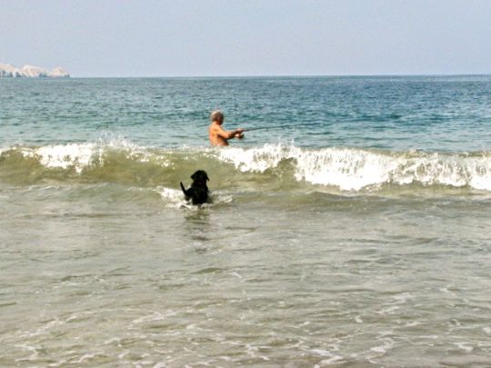
Fortunately, we didn't run into any of these fellows wandering Playa Municipal. This bronze statue of a full-sized crocodile is one of several lurking in this beautiful little garden along the malecon. The American Crocodile (Crocodylus acutus) can be found along the shores of Zihuatanejo Bay, as well as many other places along the coast to the north and south. Viewing the statue, I recalled reading about a norteamericano family who visited Mexico's Pacific coast not long ago. The back yard of their vacation cottage ran down to one of the lagoons typically found behind the long beaches. After they unpacked they threw open their back door. Their labrador retriever, joyful at his freedom after the long car trip, bounded down the yard and jumped into the lagoon. He was immediately seized by one of the lagoon's resident crocs, no doubt joyful in his own way for the sudden appearance of this large meal. The family stood by in horror but could do nothing as their pet disappeared under the water. They could only be glad it was not one of their small children. It's always good to use discretion around unfamiliar bodies of water.


A pescador shakes small fish out of his "cast" net. They are probably anchovies for his own use or to sell for bait. We often saw men (never women) fishing with cast nets like this. The pescadores wade out almost chest deep, then cast the net in front of them before gradually pulling it in. That takes a lot of strength in the arms and shoulders and this guy looks pretty fit. None of the pescadores using a cast net ever seemed concerned about the crocs which are occasionally spotted in the area. I don't know whether this indicates some special knowledge, or simple fatalism.


This catch was achieved farther off shore. I haven't been able to determine what the silvery fish are, but the greenish-golden one is a dorado, also known as mahi-mahi. These four were laid out under the palms for the examination of possible purchasers. They are quite sizable, ranging from about .6 m (2 ft) for the small one in the foreground, to about 1.2 m (4 ft) for the dorado.


Statue of a woman near the plaza represents the Region Tierra Caliente. She is one of seven female statues located near the malecon. Each represents a different region of Guerrero. Her elaborately braided hair and traditional clothing identify her as an indigenous woman from the region of Guerrero known as Tierra Caliente (the "Hot Lands"). This area is inland from the Costa Grande and is known for its fruit orchards. The other regions of Guerrero are Norte, Centro, Montaña, Costa Chica, and Acapulco.


With the fishing boats in, Brown Pelicans crowd around looking for a treat.  These large birds are graceful in flight and while cruising the water's surface, but are rather comical on land. The Brown Pelicans bear a faint resemblance to Charlie Chaplin's famous Little Tramp character as they waddle about in their brown tuxedos. The pelicans are remarkably tolerant of people and almost need to be pushed out of the way to get through their massed ranks. This flock was intently focused on a pescador cutting up his catch.


The pescador uses his sharp knife to fillet his catch. Every few minutes he amused himself. and the growing crowd of human spectators, by tossing a chunk of fish to the flock of hungry birds. This immediately set off a flapping, squawking brawl, much as might result if you tossed a handful of hundred dollar bills down on a crowded city sidewalk.


Pelicans fight over a fish in a three-way stand-off. One hilarious episode in this little drama is shown above. The pescador tossed a particularly large and succulent chunk in the air and three pelicans caught it--and each other--in a complicated standoff. The left-hand pelican has caught not only part of the fish, but the middle one's beak, while the right-hand pelican clings on to one end. They swayed back and forth, with nobody willing to give up. Finally, one of them gave a jerk and got away while the others vainly pursued. When he gained a little distance, he tossed back his head and swallowed the chunk of fish whole.


Although the pescador gave the pelicans quite a feast, he had plenty left for himself. The pescadores and the pelicans seem to have a genuinely symbiotic relationship, with each providing something to the other and each gaining something. I could see what the pelicans got but I didn't understand the quid pro quo. Then early one morning I watched from the Hotel Irma balcony as a huge flock of pelicans created a ruckus in the bay just off shore. Soon, the pescadores' boats began closing in from all directions. A waiter at the hotel restaurant explained that the pelicans had cornered a large school of anchovies in the shallows. The pescadores swooped in with their nets to gather the anchovies for bait, and the relationship became clear.


Statue of a young girl with a large pan of fresh fish. She represents the Costa Grande, a region that runs from the northwestern coast of Guerrero down almost to Acapulco. Inland from the beaches are woodlands, orchards, and fertile lands. In prehispanic times, the Costa Grande area was much coveted by both the Tarascan Empire and the Mexica (Aztecs). Behind the statue are some of the small hotels, restaurants, and shops that line the street paralleling the malecon.


Tourists carrying the inevitable bags of knicknacks stroll the malecon. You can buy straw hats, t-shirts with Ixtapa-Zihuatanejo embroidered on the front (I got two), and various other small souvenirs at the little shops along the malecon. There are even more shops in the 3-block by 6 block area that makes up El Centro, just back of the beach. Most of the wares are the usual trashy trinkets one finds at any beach community, but almost anybody can find something they like. The fun is in the looking and the bargaining.


La Sirena Gorda restaurant attracted me with its sign and its reputation. La Sirena Gorda (The Fat Mermaid) sits right on the malecon, so it is a good spot not only to eat but to people-watch. When we were looking for a malecon restaurant to try one day, Carole consulted her Lonely Planet guide and discovered that La Sirena Gorda came highly recommended. We remembered the sign we had seen on a previous stroll this way, so we stopped for lunch. The food and service were good and the prices moderate. We sat just behind the screen of cactus to the left and were able to people-watch to our hearts' desire.


The Navy Headquarters was right across the walkway from La Sirena Gorda. Although there were many handsome young Naval officers and sailors of both sexes bustling about, unfortunately none were there when I was ready to shoot this photo. The Navy has responsibility not only for anti-smuggling campaigns, but the Mexican Marines have played a strong role in the fight against the narcotraficantes. I was impressed by how many uniformed women, both officers and sailors, were in evidence For all its reputation as a macho country, Mexican women have penetrated most of the traditionally male occupations, including the military and the police forces.


A Naval patrol boat swings gently at anchor in the middle of the bay. Shallow draft boats like this are ideal for coastal patrol work. My guess is that this craft could speed right along if necessary. We never saw anything larger than this during our stay. However, the Mexican Navy doesn't have far-flung responsibilities. They have their hands full just patrolling Mexico's lengthy coasts.


The statue representing El Norte stands near the Plaza del Artista. El Norte is part of a Free Trade Zone and is full of plants that assemble parts brought in from elsewhere. It is the manufacturing center of Guerrero. Notice the elaborate embroidery on the girl's dress, as well as the mask she holds in her hands.


At the north end of Playa Municipal is a long pier jutting out into the bay. At the end of the pier on the far left you can see one of the Navy patrol boats tied up. The channel into the marina is just behind the pier seen above. The pier is the point where tourists can take various kinds of boat tours. These include sunset cruises around the bay, ferries across to Playa Las Gatas (see Part 1 of this series), or cruises up to Ixtapa or other locations. Behind the marina channel, the mountains rise sharply up.


The northern arm of the Zihuatanejo Bay contains a scattering of homes built into the cliffs. The twin catamarans shown in previous postings rock at anchor in the shelter of this wooded arm of land. the northern and southern arms of the bay give it a great deal of protection from the force of the open Pacific beyond. I took this shot in the early morning as the golden rays of the sun bathed the boats and homes in the distance.


Cliffside homes perch above the rocks lining the shore. This is the tip of the northern arm, an area called Puerto Mio ("My Port"). Even in Mexico, it must have cost a great deal to build these homes in such precarious spots. I imagine that the view must be pretty dramatic in stormy weather, with great waves crashing onto the rocky points just below the open decks of these houses.


A couple of pescadores try their luck as the sun drops below the horizon. We could always depend upon a dramatic, flaming sunset at Zihua. Playa Municipal is in shadow on the right of the photo. Next week, we'll take a look at Ixtapa to the north of Zihua, and also at the long, empty, palm-fringed beaches of Barra de Potosí to the south.

This completes Part 3 of my Zihuatanejo series. I always appreciate and encourage feedback. If you have a comment or question, please either use the Comments section below or email me directly.

If you leave a question in the Comments section, PLEASE leave your email so that I can respond.

Hasta luego, Jim

Sunday, February 10, 2013

Zihuatanejo Part 2: Playa Madera

Bronze sculpture of a beautiful girl basking on a rock along Playa Madera. This is one of seven statues of indigenous women along Playa Madera and Playa Municipal. The bronze statues, each slightly larger than life, represent indigenous women of the seven regions of Guerrero. They were created by sculptor Crecencio Oregon as part of a Zihuatanejo beautification program. The statue above represents Acapulco, the famous colonial port that became a popular playground for the rich and famous in the 1950s and 60s. In this posting, I'll take you for a walk along Playa Madera to give you a sense of it at various times of the day.

The coast of Guerrero has long been known for its tropical woods, including cedar, oak, and walnut. Playa Madera ("Wood Beach") gained its name because it was the place where such fine wood was loaded onto ships heading to ports around the world. The origin of Zihuatanego's name is somewhat more obscure. One translation, from the Purépecha language of the Tarascan Empire, means "water of the yellow mountain." However, in the language Nahuatl of the Aztecs, Cihuatlán, means "place of the women." This may refer to the paradise of the  female goddesses whose duty was to lead the sinking sun toward the west and ultimately into the darkness of Mictlán, the place of the dead. I like the second explanation better, because it ties in nicely with the lovely bronze statues lining the shore, as well as their human counterparts playing on the beach.


Condos on the point known as "Chain of Rocks" glow softly in the late afternoon sun. The surf along Playa Madera is very gentle and makes the beach ideal for swimming. Several people on the lower left are enjoying a cool dip during the afternoon heat. The point above forms the southern tip of Playa Madera's the crescent beach. On the other side of the point is the northern end of Playa La Ropa, seen in the last posting. Notice the precipitous way that the coastal hills drop directly down to the water in some places. There is no way to walk along the water around this point to Playa La Ropa. To do that, you have to walk on a street up over the hill.

Zihuatanejo's recreational potential was recognized very early. Approximately 1400 AD, Tarascan Emperor Tanganxoan II discovered beach vacations. He liked to bring his many wives down to the shores of this lovely bay, particularly favoring Playa las Gatas (see previous posting). In order to create an area of safe, quiet water for bathing in that little cove, the Emperor built a stone underwater reef that still exists. The Mexica (Aztecs) under the Emperor Ahuitzotl conquered the area in 1497, dispossessing the beach-loving Tarascans. During their rule, the Mexica established a temple for the goddess Cihuatéotl, whom they revered as the mother of the human race and the goddess of warriors fallen in battle. 


A small hotel overlooking Playa Madera blends with the vegetation and contour of the land. One of the charming aspects of Zihua, as it is known by the locals, is how often structures like this have been designed to blend in, rather than ostentatiously stand out. Notice the extensive use of palm leaves to thatch the roofs. They are light, cool and, when woven thickly together, are almost impervious to rain. However, high winds can sometimes blow them apart.

In 1522, only months after conquering the Mexica, the Spanish under Gonzalo de Umbria arrived in the Zihua area. Gonzalo was sent by Hernán Cortez to look for gold and generally reconnoiter the area. When the Spanish appeared, most of the indigenous population literally "headed  for the hills," escaping into the mountains, never to return. This gave the haciendas in the area a completely different character than those found in the rest of Mexcio. Lacking indigenous slave labor, the Spaniards were for once forced to do the work themselves. There wasn't much gold in the area, so their haciendas produced cotton, chocolate, vanilla, and corn, as well as fine wood cut in the forests of the coastal mountains. 


Early morning shadows cover the beach as gentle waves lap at a rocky point. The walkway shown above winds along the shore from the south end of Playa Madera to the marina channel at the northern end of Playa Municipal, except for a short stretch of open sand at one place.

Zihuatanejo also figured in some of the early Spanish maritime expoits. In addition to searching for gold, silver, and other treasures in Nueva España (New Spain, i.e. Mexico), the Spanish were vitally interested in establishing a trade route to the East Indies. This was, after all, what Colombus' voyages were originally about. Zihua first appears in historical records in a report by Cortés to King Charles V of Spain. The Spanish had identified the Philippines as the key to the East Indies trade when Magellan stopped there in 1521. Now they needed a launching point for an expedition that would create a direct link to the East Indies from Nueva España. 


Local students have waged a fairly successful clean-up campaign. This hand-painted sign reminds passersby that "Throwing trash at the world is like throwing the world into the trash." Signs with varying versions of this message hang from trees at regular intervals. Underneath, the students have placed small wooden fruit crates to collect the trash. While this hasn't eliminated the problem, it appears to have helped a great deal. I am  guessing that "Prepa5" means that the students are in the 5th grade.

Cortés wrote to King Charles that Zihua's protected bay was a good possibility for a West Coast port. The ships that first sailed from Nueva España to the Philippines were built at Zihua, using the abundant lumber. They were christened the Florida, the Espiritu Santo, and the Santiago. The little fleet sailed from Zihuatanejo Bay for the East Indies on Oct. 31, 1527 under the command Captain Alvaro Saavedra Cerón. This was only six years after 1521, the year the Mexica capital of Tenochtitlán fell, and also the year of Magellan's visit to the Philippines. In the context of the times, it was a lightning-fast move and it set Spain up as the dominant power in the world for the next couple of centuries.


Dotted here and there along the Playa are small outdoor restaurants. This is the one short stretch of beach where there is a break in the cement walkway. Fortunately, the sand is firm and can be walked easily. Waiters for these restaurants hang out on the beach and try to persuade potential diners to stop at their establishment.

Of Captain Saavedra Cerón's Zihua-built ships, only the Florida made it to the Philippines. Although it never returned to Nueva España, the link was established. The Spanish could now challenge Portugal's East Indies trade dominance. Unlike Spain, Portugal had managed to reach the East from the opposite direction by sailing around Africa's Cape of Good Hope. It took a couple of more attempts to establish a strong Spanish base in the Philippines, and it was not until 1565 that they finally managed it. 


Youngsters wrestle in the water near the surf line. I learned later that salt water crocodiles have been spotted in this area, probably hoping for tasty morsels like these. A friend of mine told me that he was swimming offshore during a visit to Zihua and saw people on the beach frantically waving at him. He finally realized that what he thought was a floating log not far away was a croc. He removed himself from the water with all due speed.

In 1565, Nueva España's Viceroy Luis de Velasco sent Captain Miguel López de Legazpi on the first voyage to the Philippines that ended with a return to Nueva España. The problem was with the prevailing winds. The Spanish knew how to use them to travel west, but at that latitude they were blowing the wrong way to come back. Legazpi took along a navigator-priest named Fray Andrés de Urdaneta. When Urdaneta attempted the return to Nueva España, he sailed north instead of east, taking a chance on finding easterly prevailing winds at a higher latitude. Reaching the southern tip of Japan, he found winds that might take him from west to east.  His gamble succeeded and he made the first documented return voyage across the Pacific, making landfall on the coast of California. Urdaneta then made the long trip down the coast to Acapulco, with stops here and there that may have included Zihuatanejo Bay. Whether he paused there or not, later galleons that followed his route certainly did. 


The cement walkway winds around some rocky points along the way. In the background is the northern part of Playa Madera. Behind the Playa, homes and hotels rise up the sides of Cerro de la Madera ("Wood Ridge"). The fruit crate under the lamp post on the right is one of the trash collectors left by the students.

The China trade, not the Philippines, was the ultimate prize.  China's porcelain, silks, and other wonderfully crafted luxury goods were much more important than anything the Philippines produced. They could be easily purchased with the fantastically abundant silver produced by the Spanish mines in Nueva España and Peru. The importance of the Philippines to Spain was its great harbor at Manila, which became the collection point for goods procured all along China's coast, as well as from other areas in the East Indies. There were any number of possible ports to receive these goods along the coast of Nueva España, including Zihuatanejo. However, the Spanish King, who was by now Phillip II, wanted to maintain strict control over this great torrent of wealth. It was essential to his power and ambitions in Europe. Under Spanish law, the king could demand his quinta (1/5) of all profits produced in the trade with Nueva España and the East Indies. Using multiple ports made control of the trade more difficult. In 1561 the King had the foresight to choose Acapulco as the sole port of entry on Nueva España's West Coast. In 1565, when the link was made to the East, the great ships began carrying silver to Manila and Chinese wares on the return trip. The Acapulco-Manila Galleons of legend were thus established


A fisherman tries his luck on the rocky point at the northern end of the beach. His equipment is simple: a hook and a weight on the end of a fishing line wound around a plastic bottle. I was curious about his likelihood of success, so I dallied for a bit to watch.

Acapulco was chosen over Zihuatanejo because the distance between Acapulco and Mexico City was only 300 km (190 mi) and there was an existing road and some port facilities. By contrast, Zihuatanejo lay 374 km (233 mi) away  and there was no viable road through the tangled mountains of Michoacan and Guerrero. In addition, it had little in the way of an established port. However, Zihua continued to play a role in its own way. Because the galleons from Manila reached the Western Hemisphere at California, they had a long sail down the coast to reach Acapulco. Zihua's bay served as a safe harbor during storms and a place to take on water and make repairs. In the last part of the 16th Century, when the Spanish shipyards at Zacatula burned, new shipyards were built at Zihuatanejo to handle galleon repairs.


To my surprise, the young man almost immediately hooked a small fish. He was pleased to show it off for my camera. You can see the white fish at the end of the line below his right hand. There appears to be a large population of various kinds of fish both in the bay and in the ocean just outside. Fishermen use a variety of techniques, including simple hand lines like this, to rods and reels, to hand nets, to large nets pulled by powerboats. This area has been known for its excellent fishing for thousands of years.

Unfortunately for the Spanish, Zihuatanejo Bay also played a role in the long history of piracy against their galleons. Over the centuries, pirate ships would lurk in the bay, waiting for a galleon to come by. Ships captured elsewhere would sometimes be brought to Zihua for repairs. Because the Pacific was considered a "Spanish lake" during the early years of the China trade, galleons often went unarmed to save weight and cargo space. This made them easy prey, at least for a time. Some of the visiting pirate notables included the Englishmen Sir Francis Drake and William Dampier. Drake was a 17th Century figure, working covertly for Elizabeth II. His savage attacks on Spanish possessions in the New World helped bring on war with Spain and Phillip II's famous (and disastrous) Armada invasion. William Dampier was a pirate who became the first man to circumnavigate the planet three times. In the Archaeology Museum previously mentioned, a rusted cannon is on display that was recovered by divers from the bay. It came from a Spanish galleon captured by Dampier. He brought his prize to Zihua to make repairs and to recruit crew to help sail it back to England. Unable to find any suitable recruits, he burned and sank the galleon. Admiral George Anson was not a pirate, but major figure in the 18th Century British Navy. During his operations against Spanish shipping in the 1740s, he sank the ship Caramela in Zihuatanejo Bay. 


People get around the bay in many ways, this being one of the more exciting. In addition to jet boats like the ones above, the bay swarms with fishing craft, sailboats, kayaks, Naval patrol boats and launches full of tourists. Watching all of this water traffic can be quite entertaining.

Aside from the excitement of occasional pirate raids, things drowsed along at Zihua through the 18th and into the 19th Centuries. The lack of a road to the interior meant that contact with the outside world was seaborne and sporadic. Zihua largely escaped involvement in the 1810-1821 War of Independence, except for its use by insurgent leader José María Morelos y Pavón as a logistic port during 1811. Nearly 100 years went by before Zihua again played a role in national events.

Kayaks are available to rent at various locations along the beach. In this shot, you are looking directly across the bay toward Playa Las Gatas, where the wives of Tanganxoan II once frolicked. The sailboat in the center is one of the large catamarans that are used to take tourists on sunset cruises. I took the panoramic shots seen in the previous posting from the hills in the background.

When the Mexican Revolution broke out in 1910, four well-known brothers from the Zihua area, Alfredo, Leonel, Hector, and Homero Lopez signed up with the revolutionaries. The feeling in the area was generally pro-rebel, and the Lopez brothers were soon joined by many others. Conflict arrived soon at sleepy Zihua as rebel groups fought with federal troops, and with each other. During this period, Zihua was pillaged and vandalized at various times. While the main fighting during the Revolution lasted from 1910-1917, various uprisings and conflcts continued until the late 1920s in different parts of the country. In 1926, a rebel group called the "Vidalistas" brought 1000 men to attack government installations in Zihua in an attempt to free some of their leaders who had been imprisoned. Government officials made a secret agreement to release them in return for a rebel withdrawal.


Young love on the beach. Set into the rocky points along the way are various benches that make convenient spots for couples to snuggle. This young musician and his girl friend seemed amused by my desire to capture their moment.

In early colonial times, a Spaniard named Anton Sanchez received an encomienda (a precursor to the hacienda system) that included the Xtapa area. Spanish galleons on the Manila-to-Acapulco leg brought coconut palms from the Philippines and they gradually became a large-scale export crop at the Xtapa hacienda and elsewhere along the Costa Grande. In 1952, coconut workers at Xtapa and many other haciendas staged a major strike all along the coast from Zihuatanejo to Acapulco. During the strike, roads into Zihua were blocked.


Palm fronds dry in the afternoon sun. I noticed a young family laying these out on the beach and stopped to observe. They confirmed that these would be used to roof one of the many palapas (open-sided, palm-thatched huts) found along the beach.

Until the 20th Century, Zihuatanejo never became much more than a tiny, sleepy, fishing village of less than 5,000 people. The only practical way to visit was by boat. In 1920, the Prince of Wales visited Acapulco down the coast, announced his enjoyment, and spurred interest in the area. Wealthy yachtsmen began to cruise the coast, as pirates had in previous centuries. Some of them dropped anchor in Zihuatanejo's pristine Bay and word began to get around. Lacking other facilities, these outsiders stayed in private homes or on their yachts anchored offshore.


Still another way to get across the bay. Parasailing is very popular and one of these colorful parachutes can often be seen crossing the sky in the distance. I tried this once on a visit to Cancun years ago. It was quite scenic, but I couldn't help noticing that the only things connecting me to the chute were two small metal clips. My north-of-the-border sensibility immediately kicked in and I began to think about proper maintenance and regular inspections as I peered down at the water hundreds of feel below. Fortunately, I landed without incident.

In the 1950s, the construction of a small airport brought in a modest increase of visitors. This finally forced the laid-back locals to put up a few small hotels. Still, there were no roads connecting the village to the outside world until the 1960s when one was built up the Costa Grande from Acapulco. Then, in the early 1970s, everything began to change. The government decided to create major destination resorts at Cancun, on the coast of Yucatan, and near Zihuatanejo on the Costa Grande.


Playa Madera ends at the right side this pedestrian bridge. Playa Municipal begins on the left side. The bridge stretches over a long arroyo (creek bed) that cuts down from the hills behind Zihua, through the town, and finally empties into the bay. The cement-lined channel was mostly dry when we visited, but I imagine it handles quite a torrent during the rainy season. Near the left end of the bridge is the Archaeological Museum of the Costa Grande. It is a small, but very nice, museum displaying artifacts from the earliest habitation of the area through the arrival of the Spanish. I will show some of these artifacts in future postings.

The Mexican government's original idea was to develop their mega resort in Zihua, but the local community protested the destruction of the character of their little beach town. In the end, Fonatur (Mexico's Federal Bureau for Tourist Development) took over the Xtapa coconut plantation. The old hacienda lies about 5 km (3.1 mi) to the north, out of sight behind the point of land that forms the northern arm of Zihua's bay. 


A hand net fisherman tries his luck at dusk near the north end of Playa Madera. As I headed back to Hotel Irma from my beach stroll, I came across this fellow. He was standing chest deep in the calm water, gathering up his net for another throw. It must be hard work to repeatedly haul in the water-soaked net, hopefully full of wriggling fish, in preparation for another toss.

To construct and maintain the Xtapa resort, large numbers of workers were required and Zihua became their bedroom community. The population today is about 62,000. While many residents of Zihua work in Xtapa, very few live there. Xtapa remains as it was created, a tourist bubble for well-to-do outsiders, while Zihua has remained a blend of overgrown fishing village and quirky, laid-back, beach community.


Another spectacular sunset, looking toward the northern arm of Zihuatanejo's bay. Carole was waiting for me back at Hotel Irma, but I didn't think she'd mind if I stopped for one last shot. Next week, we'll take a look at Playa Municipal, the busiest of all the beaches along Zihua's shore.

This concludes Part 2 of my Zihuatanejo series. As always, I appreciate feedback or corrections. If you want to leave a comment, please do so in the Comments section below, or email me directly.

If you leave a question in the Comments section, PLEASE leave your email address so I can respond.

Hasta luego, Jim