
Structure II is a huge, complex, multilevel pyramid. What we see today is the last of multiple modifications that occurred over the city's 1,400 year history. The most recent of these was completed in the Terminal Classic era (600-900 AD). This period preceded Calakmul's collapse and abandonment. The base of Structure II measures 140m (459ft) on each of its four sides and the pyramid rises 55m (180.4ft) up from the plaza. From the ground to the very top there are at least eight levels. Structure II is the largest building in Calakmul and one of the largest in the whole Maya area. Levels three to six are connected by broad central staircase. There are also several smaller stairways. The remains of workshops and housing for ancient craftsmen can be found on the first few levels of the north facade.
The central staircase ends at level six, which contains Structure IIb. At one time, this was the ruler's palace. The now-roofless building has three north-facing doors and contains nine rooms. On the east and west sides of Structure IIb are smaller structures called IIc and IId. They once housed high status individuals and their families. On the south end of level six, behind Structure IIb, is a temple pyramid with three staircases on its first level. A single, central staircase leads up to the top of the second level, which is the highest point on Structure II. (Photo from the Maya Ruins Website)
Overview
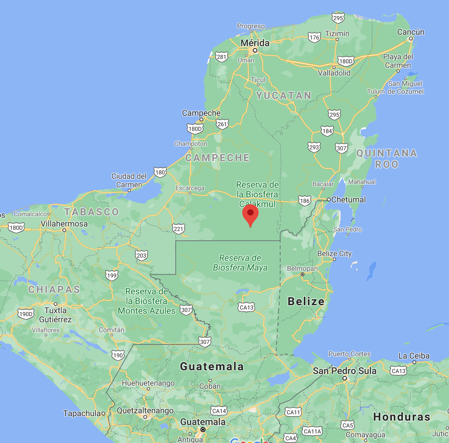
Calakmul was one of the two most important cities of the Classic Maya era. The other was its bitter enemy Tikal, lying 97km (60mi) to the south in today's Guatemala. Tikal draws many thousands of tourists each year, but Calakmul receives relatively few. Reaching these remote ruins requires a good deal of time and determination. The main highway passing through the Biosphera Calakmul is Mexico 186. This paved and well-maintained road spans the neck of the Yucatan Peninsula, connecting the Caribbean Coast with the Gulf of Mexico. Along the way, there are hotels, restaurants, and gas stations. However, conditions change once you turn south on the road leading to the ruins.
From the Highway 186 turnoff to Calakmul is 61km (38mi). That may sound like a short drive but it can take from 1.5 to 2 hours. Although paved, the road is narrow and heavily potholed for much of the way, requiring low-speed driving. Except for a small museum about half way to the ruins, there is nothing along this road but jungle. If you decide to visit Calakmul, make sure to gas up in advance and bring lunch and plenty of water. When we arrived at Calakmul's parking lot, it contained less than ten cars, including those of the caretakers. The ruins themselves cover quite a large area and we rarely saw another person. However, monkeys, birds, and other wildlife were plentiful. To tell the truth, that's just how we like it when we visit an ancient site like this. Click this Google map to see the route.

The Maya considered vultures to be extraordinary beings. They were associated with war and the sun and their remains have been found in the tombs of rulers. Sculptures and paintings of Maya kings often portray them standing upon the bodies of live war captives or dead enemies. The association of vultures with rulers may have occurred because carrion-eating vultures often stand on the corpses of animals upon which they are feeding.

Since the round-trip travel time between our hotel in Xpujil and Calakmul was about five hours, our time at the ruins was limited. We only explored the structures of the Gran Plaza and the Acrópolis Chii'k Naab . Together, those two areas make up about 1/4 of the total excavated site. In turn, the excavated site itself represents only a portion of the 6,250 structures that have been surveyed. In fact, the surveys conducted to date may not have captured all, or even most, of the structures that once made up this metropolis. The newly developed jungle-penetrating radar called LiDAR has not yet been used at Calakmul. However, in other parts of the Petén, it has revealed tens of thousands of structures where it was once believed none existed.
In addition to limited time, we were also hampered by the lack of a hand-size map to guide us around the ruins. Unlike ancient sites in the northern part of the Yucatan Peninsula, those in the south often do not provide you with maps when you check in at the gate. While there were large display maps at Calakmul's gatehouse, there was nothing I could hold in my hand as we wandered blindly down the jungle trails. Before you visit, make sure to download and print out site maps of Calakmul to help you navigate this complex ruin.
Structure II over the centuries


Calakmul got its start during the Pre-Classic era (600 BC-250 AD). At that time, a civilization called El Mirador (The Lookout) dominated the Petén region. El Mirador Valley is located in northern Guatemala, about 38km (24mi) south of Calakmul. At one time, archeologists had thought that Calakmul had been founded by refugees from El Mirador, who were fleeing its collapse around 100 AD. However, it now appears that Calakmul developed during El Mirador's heyday and became important in its own right as El Mirador declined. It is certainly possible that some of the former residents of El Mirador migrated to Calakmul and thus helped transform it into a great city at the beginning of the Classic era.

The original settlers at Calakmul arrived around 500 BC. They built their community on a raised limestone area about 25 square kilometers in size that was surrounded by large bajos (low areas or swamps). The two largest were called El Labertino and El Ramonal. These bajos provided the new community with easy access to water. However, over the following centuries, increases in population required more water. Calakmul's inhabitants solved this problem by constructing a number of reservoirs to store water collected during the rainy season. Ultimately, the total reservoir capacity grew to the point where it could meet the needs of 50,000 people.
The soil on the limestone ridge was thin, so the inhabitants brought fertile mud up from the swamps to create raised gardens. There, they could cultivate maiz, beans, squash, and other crops. The area also contained a large supply of chert, a stone from which tools could be fashioned. So, with plentiful water, access to good soil and chert for tools, and an unlimited supply of limestone for building materials, most of the elements were in place for Calakmul's success. The final great advantage was location. As outlined earlier, the growing city occupied the geographic center of the Maya world. This position held great strategic importance in terms of politics, trade, and military conquest.

Structure II's modifications over the centuries began after the construction of the earliest version (see previous cutaway image). It was built sometime during the Middle Pre-Classic (390 BC-250 BC). The pyramid was intended to replicate the Witz (sacred mountain), which was believed to contain a portal that led to Xibalba (the underworld). In the Maya's cyclical cosmos, Xibalba was the place of death and rebirth. On top of Structure II's original main platform, there once stood a single-story building. This structure contained an altar and, reputedly, Xibalba's portal. On top of the building was a narrow, flat, upright panel called a roof comb. Its purpose was to support stucco decorations possibly including a large mask.

During the Late Pre-Classic (100 BC-250 AD) the building containing Xibalba's portal was covered over by a larger building. The new structure was used as a burial site for rulers and other high-status individuals. This modification not only changed the physical appearance of Structure II but added a political function to its on-going religious function. Eventually the great pyramid would contain the tombs of at least nine different kings.
Some rulers were buried under the new building's floor and an effort was made to conceal the tombs from robbers, who seem to have been a problem even in those early times. Later, during the Early Classic (250 AD-600AD), the tomb building was, in turn, covered over by another new construction. The remains of that new building, which archeologists call Structure IIb, are what we see today at the top of the great staircase.

These final changes are a reflection of Calakmul's decline. Prolonged drought depopulated much of the Petén. Some of the people left the area entirely and moved into the still economically vibrant northern areas of Yucatan. Those inhabitants of Calakmul's domain who remained withdrew into the city's center. As the Classic Maya world of the Petén lowlands collapsed, Calakmul's economic and cultural focus began to shift toward the north.
The northern areas were not as much affected by the droughts. Some, like Edzna, had water systems of much greater capacity than Calakmul. Others, such as Dzibilchaltún had year-round sources in nearby cenotes. This shift in Calakmul's economic and cultural focus was also reflected in architectural design. Multifunctional pyramids like Structure II can also be found in Maya cities to the north, including Edzna's Pyramid of the Five Levels and Sayil's Great Palace. It is not clear whether Calakmul followed their example, or the northerners copied what they observed at Calakmul.
The stelae of Structure II

The north facade of Structure II as it appears today. The north facade is decorated with numerous stelae. These are upright, two-sided, stone monuments that look a bit like a tombstones. They are sometimes smooth but often covered with carved images and hieroglyphic text. Over the centuries, rulers commissioned them to commemorate special occasions. These might include an accession to power, a victory in battle, or the celebration of an important date in the Maya calendar. The five stelae in the foreground above were erected at the beginning of the Eighth Century. They stand at the base of the stairs, while others are located at various levels of the north facade. The white monument in the center of the stairway contains the image of the wife of an important ruler. The stelae shown in this section of my posting are among the most important at Structure II.


The discovery of this Early Classic stela was important because all other stelae found up until then were from the later in the Classic period. Specific dates are important, because they can be connected to specific rulers, dynasties, and events. From that, a chronology can be developed and compared to chronologies of other cities. Gradually, the complex history of a whole region starts to emerge.
Sometimes there are references on one ancient city's monuments to other contemporaneous cities. For example, the earliest reference to Calakmul was found on a stela at the city of Balakbal. It contains the date 406 AD and its text indicates that Balakbal had a subordinate relationship with Calakmul at the time. This shows that Calakmul was already becoming an important regional power during the Early Classic era.

The front side of the stela contains the image of an elite figure. The person is shown in left profile, standing on a captive. This stance is strongly associated with rulership and military power. As befits a king, the figure is richly dressed and wears a headdress incorporating ancestors and the masks of deities. Under his left arm he holds a scepter containing the figure of K'awiil, the Maya god of lightning, serpents, fertility, and maiz. The scepter is tipped with the two heads of the celestial monster. (Drawing from Latin American Studies website)
 Left side view of Stela 43. The two narrow sides contain text, much of which is incomplete or undecipherable because of weathering. A partial name for the royal figure has been deciphered as Ah-K'uhul-?-bi-a, but archeologists don't yet know what the name means. The title K'uhul chatan winik is also included in the text. However this probably refers to the subordinates of the figure shown, because the title is associated with secondary leaders. While 514 AD is the earliest date on the monument, it also contains three later dates. It may be that the stela commemorates several battle victories, perhaps won by the secondary leaders. The presence of the captive under the king's feet supports this possibility.
 Stela 114 contains the Maya date corresponding to September 16, 431 AD. This discovery pushed Calakmul's earliest historical date back by 83 years before the date on Stela 43. These are the only two stelae at Calakmul from the Early Classic period. Stela 114 had previously be located somewhere else. During the Terminal Classic period, it was moved to a covered niche at Structure II near the bottom of the north facade. Its new location would have placed it out of the view of casual passersby, but still accessible to priests and other elites.


An altar found in front of Stela 114 contains evidence of burnt offerings, including human bones. Sometime in the Late Terminal Classic, the niche was covered over by modifications to the pyramid. These very likely included the the homes and workshops of craftsmen. Stela 114 was not seen again by human eyes until 1994, when it was discovered by archeologists working under William Folan. (Photo from Architecture of Petén at Calakmul: A Regional Comparison)

The back of the stela and its narrow sides are covered with more than 90 glyphs containing a considerable amount of information. Unfortunately, the limestone surface is so eroded that only fragments of names remain. The order in which they appear, however, indicates that the names include not only the ruler, but those of his mother and father. (Drawing from Latin American Studies website)
 Stela 116 was carved from white limestone and stands in the middle of the great staircase. The stela was erected in 692 AD, near the height of Calakmul's power. The figure on the front of the monument is a female who was probably the mother or wife of Yich' ak K'ak (Jaguar Paw). Her name is represented by the symbol for a god's head, paired with the glyph for female. Another glyph on the stela is the emblem for the city of Dos Pilas, one of Calakmul's subordinate allies.

Jaguar Paw, whose tomb was found within Structure IIb, was one of Calakmul's great rulers. It is possible that the woman on Stela 116 was his wife, through a political marriage that cemented the alliance with Dos Pilas. Another possibility is that she was Jaguar Paw's mother, who may have married his father for similar political reasons.
This completes Part 1 of my Calakmul series. In the next posting, I will show the tomb of Jaguar Paw and artifacts from other elite burials at Structure II. I'll also walk you through the palace and elite residential areas that once occupied level 6 of Structure II. I hope you have enjoyed this posting and, if so, that you will please leave any thoughts and questions in the Comments section below or email me directly. If you leave a question PLEASE leave your email address so that I can respond.
Hasta luego, Jim
Amazng! Thank you for what you do!
ReplyDelete